فائل:Tangier Zone txu-oclc-6949452-ni30-1.jpg

اس نمائش کا حجم: 410 × 599 پکسلز۔ دیگر تصمیمات: 164 × 240 پکسلز | 329 × 480 پکسلز | 949 × 1,386 پکسلز۔
اصل فائل (949 × 1,386 پکسل، فائل کا حجم: 1.2 MB، MIME قسم: image/jpeg)
خلاصہ
| تفصیل |
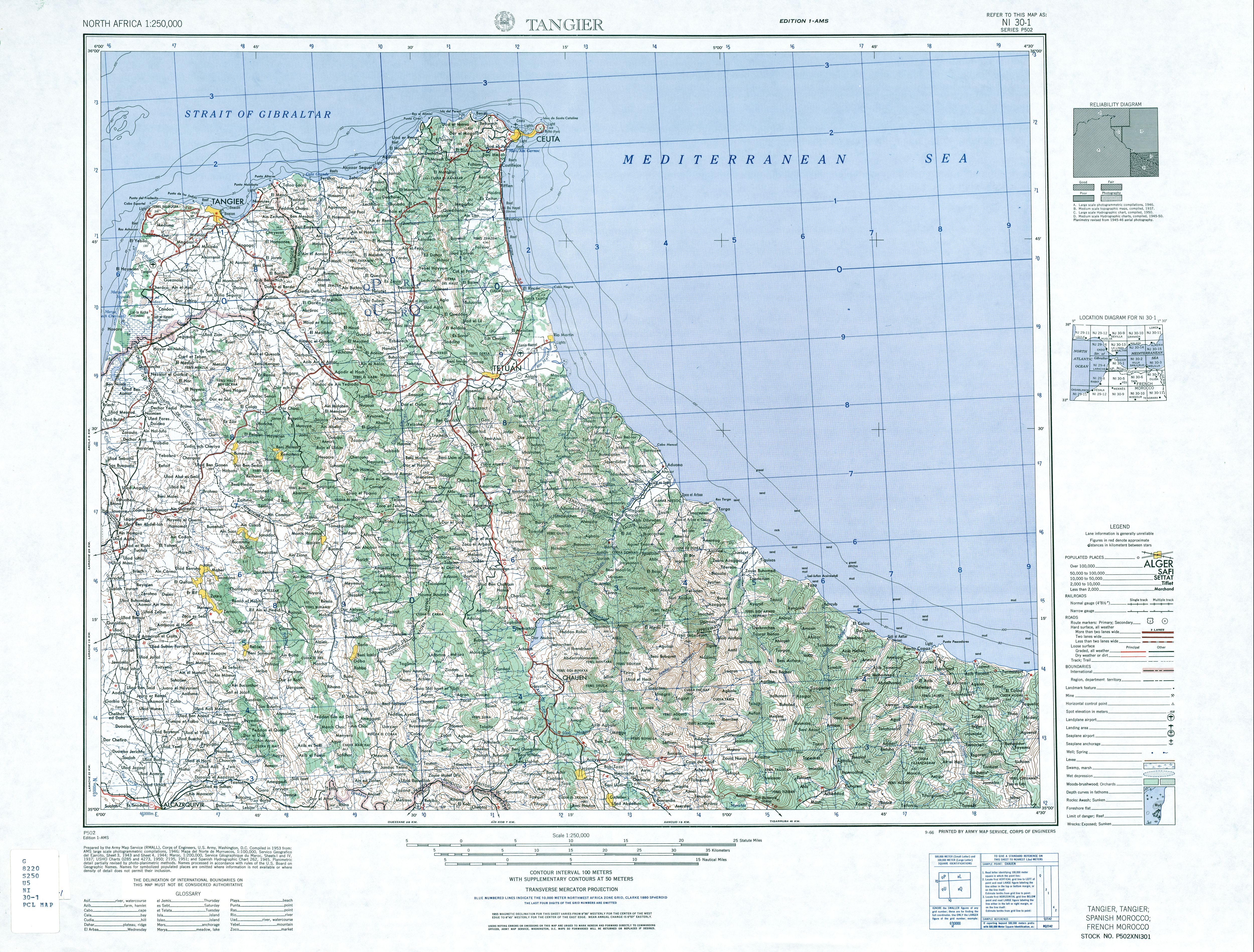
English: map of the area of the former International Zone of Tangier, Morocco |
| تاریخ | |
| ماخذ | http://www.lib.utexas.edu/maps/ams/north_africa/txu-oclc-6949452-ni30-1.jpg |
| مصنف | Army Map Service |
اجازہ کاری
This file is a work of a U.S. Army soldier or employee, taken or made as part of that person's official duties. As a work of the U.S. federal government, it is in the public domain in the United States.
|
 |
-
فائل کا تاریخچہ
کسی خاص وقت یا تاریخ میں یہ فائل کیسی نظر آتی تھی، اسے دیکھنے کے لیے اس وقت/تاریخ پر کلک کریں۔
| تاریخ/وقت | تھمب نیل | ابعاد | صارف | تبصرہ | |
|---|---|---|---|---|---|
| رائج الوقت | 07:14، 29 نومبر 2017ء | | 949 × 1,386 (1.2 MB) | ديفيد عادل وهبة خليل 2 | Removed border by cropping 3 % horizontally and 2 % vertically using CropTool with precise mode. |
| 19:40، 6 جون 2010ء |  | 976 × 1,419 (1.26 MB) | Ratzer | {{Information |Description={{en|1=map of the area of the former International Zone of Tangier, Morocco}} |Source=http://www.lib.utexas.edu/maps/ams/north_africa/txu-oclc-6949452-ni30-1.jpg |Author=Army Map Service |Date=1953 |Permission= |other_versions= |
روابط
درج ذیل صفحہ اس فائل کو استعمال کر رہا ہے:
فائل کا عالمی استعمال
مندرجہ ذیل ویکیوں میں یہ فائل زیر استعمال ہے:
- ar.wikipedia.org پر استعمال
- br.wikipedia.org پر استعمال
- de.wikipedia.org پر استعمال
- en.wikipedia.org پر استعمال
- fr.wikipedia.org پر استعمال
- id.wikipedia.org پر استعمال
- it.wikipedia.org پر استعمال
- ja.wikipedia.org پر استعمال
- nl.wikipedia.org پر استعمال
- pl.wikipedia.org پر استعمال
- pt.wikipedia.org پر استعمال
- ru.wikipedia.org پر استعمال
- simple.wikipedia.org پر استعمال
- uk.wikipedia.org پر استعمال
- zh.wikipedia.org پر استعمال