فائل:Tehri Garhwal zoomed in.jpg

اس سے زیادہ ریزولیوشن دستیاب نہیں۔
Tehri_Garhwal_zoomed_in.jpg (514 × 350 پکسل، فائل کا حجم: 70 کلوبائٹ، MIME قسم: image/jpeg)
خلاصہ
| تفصیل |
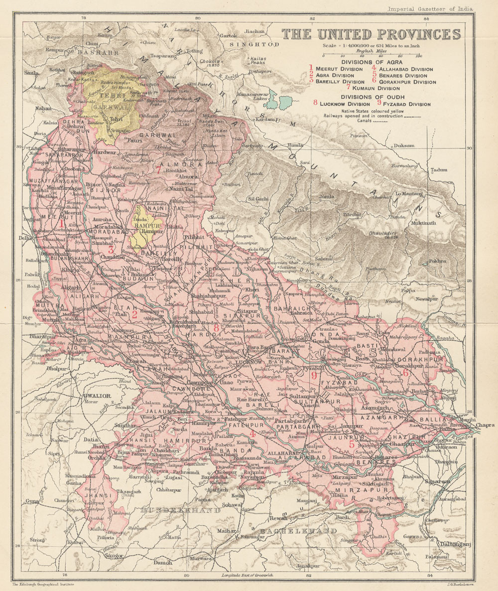
English: This is the map of Tehri Garhwal state made by British cartographer John G Bartholomew |
| تاریخ | بین 1,907.0 و 1,909.0 |
| ماخذ | https://dsal.uchicago.edu/maps/gazetteer/images/gazetteer_V24_pg250.jpg |
| مصنف | John G Bartholomew |
اجازہ کاری
The author died in 1920, so this work is in the public domain in its country of origin and other countries and areas where the copyright term is the author's life plus 100 years or fewer. | |
| This file has been identified as being free of known restrictions under copyright law, including all related and neighboring rights. | |
فائل کا تاریخچہ
کسی خاص وقت یا تاریخ میں یہ فائل کیسی نظر آتی تھی، اسے دیکھنے کے لیے اس وقت/تاریخ پر کلک کریں۔
| تاریخ/وقت | تھمب نیل | ابعاد | صارف | تبصرہ | |
|---|---|---|---|---|---|
| رائج الوقت | 12:19، 23 جولائی 2020ء | | 514 × 350 (70 کلوبائٹ) | Abhishek0831996 | |
| 12:00، 23 جولائی 2020ء |  | 360 × 316 (44 کلوبائٹ) | Abhishek0831996 | Uploaded a work by John G Bartholomew from https://dsal.uchicago.edu/maps/gazetteer/images/gazetteer_V24_pg250.jpg with UploadWizard |
روابط
درج ذیل صفحہ اس فائل کو استعمال کر رہا ہے:
فائل کا عالمی استعمال
مندرجہ ذیل ویکیوں میں یہ فائل زیر استعمال ہے:
- bn.wikipedia.org پر استعمال
- de.wikipedia.org پر استعمال
- en.wikipedia.org پر استعمال
- hi.wikipedia.org پر استعمال
- id.wikipedia.org پر استعمال
- ja.wikipedia.org پر استعمال
- ne.wikipedia.org پر استعمال
- pnb.wikipedia.org پر استعمال
- ta.wikipedia.org پر استعمال
- uk.wikipedia.org پر استعمال