فائل:2004 Praha.png
اس سے زیادہ ریزولیوشن دستیاب نہیں۔
2004_Praha.png (619 × 356 پکسل، فائل کا حجم: 12 کلوبائٹ، MIME قسم: image/png)
خلاصہ
| تفصیل |
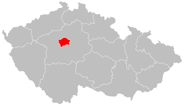
Čeština: Lokační mapa Prahy od 2004 English: Locator map of Prague from 2004 |
| تاریخ | |
| ماخذ | File:2004_Stredocesky_kraj.PNG |
| مصنف | Hustoles |
اجازہ کاری
| This file is made available under the Creative Commons CC0 1.0 Universal Public Domain Dedication. | |
| The person who associated a work with this deed has dedicated the work to the public domain by waiving all of their rights to the work worldwide under copyright law, including all related and neighboring rights, to the extent allowed by law. You can copy, modify, distribute and perform the work, even for commercial purposes, all without asking permission.
|
فائل کا تاریخچہ
کسی خاص وقت یا تاریخ میں یہ فائل کیسی نظر آتی تھی، اسے دیکھنے کے لیے اس وقت/تاریخ پر کلک کریں۔
| تاریخ/وقت | تھمب نیل | ابعاد | صارف | تبصرہ | |
|---|---|---|---|---|---|
| رائج الوقت | 21:10، 2 جنوری 2016ء | | 619 × 356 (12 کلوبائٹ) | Valdemar | new borders (law no. 15/2015 Coll.) |
| 16:38، 24 اگست 2011ء |  | 619 × 356 (16 کلوبائٹ) | Fext |
روابط
درج ذیل صفحہ اس فائل کو استعمال کر رہا ہے:
فائل کا عالمی استعمال
مندرجہ ذیل ویکیوں میں یہ فائل زیر استعمال ہے:
- ang.wikipedia.org پر استعمال
- ar.wikipedia.org پر استعمال
- arz.wikipedia.org پر استعمال
- ast.wikipedia.org پر استعمال
- ca.wikipedia.org پر استعمال
- ceb.wikipedia.org پر استعمال
- cs.wikipedia.org پر استعمال
- cs.wikiversity.org پر استعمال
- diq.wikipedia.org پر استعمال
- el.wikipedia.org پر استعمال
- es.wikipedia.org پر استعمال
- eu.wikipedia.org پر استعمال
- ext.wikipedia.org پر استعمال
- fr.wikinews.org پر استعمال
- ga.wikipedia.org پر استعمال
- glk.wikipedia.org پر استعمال
- gl.wikipedia.org پر استعمال
- ha.wikipedia.org پر استعمال
- ht.wikipedia.org پر استعمال
- ia.wikipedia.org پر استعمال
- ie.wikipedia.org پر استعمال
- kab.wikipedia.org پر استعمال
- la.wikipedia.org پر استعمال
- mdf.wikipedia.org پر استعمال
- mt.wikipedia.org پر استعمال
- mzn.wikipedia.org پر استعمال
- pl.wikivoyage.org پر استعمال
- ro.wikipedia.org پر استعمال
- rue.wikipedia.org پر استعمال
- tt.wikipedia.org پر استعمال
- uk.wikipedia.org پر استعمال
- vls.wikipedia.org پر استعمال
- vo.wikipedia.org پر استعمال
- www.wikidata.org پر استعمال
- zh-yue.wikipedia.org پر استعمال