فائل:Appalachian region of United States.png
اس سے زیادہ ریزولیوشن دستیاب نہیں۔
Appalachian_region_of_United_States.png (570 × 585 پکسل، فائل کا حجم: 56 کلوبائٹ، MIME قسم: image/png)
خلاصہ
| تفصیل |
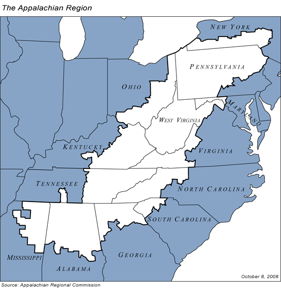
English: Map of the Appalachian region of the United States, from the Web site of the Appalachian Regional Commission, at http://www.arc.gov/images/regionmap.gif PD-USGov |
| ماخذ | http://www.arc.gov/images/regionmap.gif |
| مصنف | Jax42 at en.wikipedia |

|
This geology image could be re-created using vector graphics as an SVG file. This has several advantages; see Commons:Media for cleanup for more information. If an SVG form of this image is available, please upload it and afterwards replace this template with
{{vector version available|new image name}}.
It is recommended to name the SVG file “Appalachian region of United States.svg”—then the template Vector version available (or Vva) does not need the new image name parameter. |
اجازہ کاری
This work is in the public domain in the United States because it is a work prepared by an officer or employee of the United States Government as part of that person’s official duties under the terms of Title 17, Chapter 1, Section 105 of the US Code.
Note: This only applies to original works of the Federal Government and not to the work of any individual U.S. state, territory, commonwealth, county, municipality, or any other subdivision. This template also does not apply to postage stamp designs published by the United States Postal Service since 1978. (See § 313.6(C)(1) of Compendium of U.S. Copyright Office Practices). It also does not apply to certain US coins; see The US Mint Terms of Use.
|
 | |
| This file has been identified as being free of known restrictions under copyright law, including all related and neighboring rights. | ||
اولین اپلوڈ کا نوشتہ
فائل کی تفصیلات کا اصل صفحہ یہاں تھا۔ درج ذیل تمام صارفین en.wikipedia کے ہیں۔
Upload date | User | Bytes | Dimensions | Comment
- 2008-11-14 04:44 (UTC) | Bitmapped | 55973 (bytes) | 570×585 | == Summary == Map of the Appalachian region of the United States, from the Web site of the Appalachian Regional Commission, at http://www.arc.gov/images/regionmap.gif . Updated to include Trumbull and Ashtabula counties in Ohio as per ARC expansion. {{P
- 2005-11-05 03:12 (UTC) | Jax42 | 37690 (bytes) | 570×585 | Map of the Appalachian region of the United States, from the Web site of the Appalachian Regional Commission, at http://www.arc.gov/images/regionmap.gif {{PD-USGov}}
اولین اپلوڈ کا نوشتہ
| تاریخ/وقت | ابعاد | صارف | تبصرہ |
|---|---|---|---|
| 4 اگست 2011, 08:45:00 | 570 × 585 (55973 bytes) | SreeBot (تبادلۂ خیال · شراکتیں) |
فائل کا تاریخچہ
کسی خاص وقت یا تاریخ میں یہ فائل کیسی نظر آتی تھی، اسے دیکھنے کے لیے اس وقت/تاریخ پر کلک کریں۔
| تاریخ/وقت | تھمب نیل | ابعاد | صارف | تبصرہ | |
|---|---|---|---|---|---|
| رائج الوقت | 17:21، 17 اگست 2014ء | | 570 × 585 (56 کلوبائٹ) | GifTagger | Bot: Converting file to superior PNG file. (Source: Appalachian_region_of_United_States.gif). This GIF was problematic due to non-greyscale color table. |
روابط
درج ذیل صفحہ اس فائل کو استعمال کر رہا ہے:
فائل کا عالمی استعمال
مندرجہ ذیل ویکیوں میں یہ فائل زیر استعمال ہے:
- af.wikipedia.org پر استعمال
- ang.wikipedia.org پر استعمال
- ar.wikipedia.org پر استعمال
- en.wikipedia.org پر استعمال
- Talk:Steeler Nation
- Social and economic stratification in Appalachia
- Wikipedia:WikiProject Appalachia
- List of Appalachian Regional Commission counties
- Appalachian Americans
- Wikipedia:Userboxes/WikiProjects/Regional
- Wikipedia:Userboxes/WikiProjects/U.S. States
- User:Buaidh/sandbox
- User:Littlelago123
- Template:Portal/doc/all
- Category:Wikipedians interested in Appalachia
- Wikipedia:Meetup/Women&Art/Appalachia
- Wikipedia:Userboxes/WikiProjects/alphabetical/02
- Wikipedia:Categories for discussion/Log/2018 March 1
- Template:User WP Appalachia
- User:Mcg-2000
- User:Redwing1234
- Appalachian folk art
- User:Kentuckian
- User:Dionysius Miller
- fa.wikipedia.org پر استعمال
- ia.wikipedia.org پر استعمال
- id.wikipedia.org پر استعمال
- nl.wikipedia.org پر استعمال
- th.wikipedia.org پر استعمال
- tr.wikipedia.org پر استعمال
- tum.wikipedia.org پر استعمال
- war.wikipedia.org پر استعمال
- www.wikidata.org پر استعمال
- zh.wikipedia.org پر استعمال