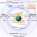
اصل فائل(ایس وی جی فائل، ابعاد 512 × 512 پکسل، فائل کا حجم: 42 کلوبائٹ)

تصویر کا اس زبان میں ترجمہ کریں ۔

یہ فائل ویکی ذخائر کی ہے اور دیگر منصوبوں کے زیر استعمال ہوسکتی ہے۔ فائل کے صفحہ تعارف پر موجود تعارف ذیل میں موجود ہے۔

This image is an animated SVG file. The .png preview above created by RSVG for use in Wikimedia is not animated and may be incomplete or incorrect. To see the animation, open media:Comparison satellite navigation orbits.svg. It should run in any modern browser or viewer. Recent versions of Chrome, Firefox, Microsoft Edge, Safari, and Opera all support SVG animated with SMIL. Other SVG animations can be found at Category:Animated SVG files.

Templates:Animated SVG/I18n
العربية | Boarisch | বাংলা | català | čeština | Deutsch | Deutsch (Sie-Form)‎ | English | español | فارسی | suomi | français | galego | עברית | हिन्दी | magyar | հայերեն | íslenska | italiano | 日本語 | 한국어 | lietuvių | македонски | മലയാളം | Plattdüütsch | Nederlands | occitan | português | português do Brasil | русский | sicilianu | slovenščina | svenska | ไทย | українська | 中文 | 中文(简体)‎ | 中文(繁體)‎ | +/−

خلاصہ

تفصیل
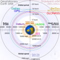
English: Comparison of GPS, GLONASS, Galileo and COMPASS (medium Earth orbit satellites) orbits with International Space Station, Hubble Space Telescope, geostationary and graveyard orbits, and the nominal size of the Earth.


For this diagram, the 3-dimensional aspect of orbits have been flattened. For instance, the view of the Earth depicted is looking down to the North Pole which makes the orbit representations appear to be equatorial. While this is accurate for geostationary orbits, other orbits listed are actually at significant inclinations. The inclination of Iridium orbits is at 86.4° which is nearly perpendicular to the diagrammed plane. Looking down to the North Pole from this zenith, a polar orbit of 90° inclination would actually appear as a straight line.
Français : Comparaison des orbites GPS, GLONASS, Galileo, Iridium et Beidou avec celles de la Station spatiale internationale et Hubble ainsi que l'orbite géostationnaire, l'orbite de rebut et la taille de la Terre.


Pour ce diagramme, l'aspect tridimensionnel des orbites a été ignoré : tout est aplati. La Terre est représentée avec le pôle Nord au centre, ce qui fait que les orbites semblent équatoriales. Ceci est correct dans le cas des orbites géostationnaires, mais les autres sont en réalité inclinées. Les satellites Iridium sont le cas le plus extrême, avec 86,4° d'inclinaison, les plaçant presque à la perpendiculaire du plan représenté. Si leur orbite était représentée de façon fidèle, nous ne verrions qu'une ligne droite sur ce diagramme.
ماخذ ذاتی کام
مصنف cmglee
دوسرے نسخے

[ترمیم]

English: Animated
Español: Animada
Македонски: Анимирано
Русский: Мультипликация
Українська: Анімація
English: Static
Македонски: Обична слика
Русский: Обычная картинка
Українська: Статичне зображення
SVG genesis
InfoField
 
The SVG code is valid.
 
This diagram was created with unknown tool.
 
 This diagram is translated using SVG switch elements: all translations are stored in the same file.

Assessment

Media of the day This file was selected as the media of the day for 12 August 2020. It was captioned as follows:
English: A detailed and informative diagram that brings to life where different satellites (e.g. the International Space Station vs. the GPS satellites) are physically located relative to Earth
Other languages
Čeština: Detailní diagram ukazující, kde se na oběžné dráze kolem Země fyzicky nacházejí různé uměle vyrobené satelity, např. Mezinárodní vesmírná stanice nebo součásti sysému GPS.
English: A detailed and informative diagram that brings to life where different satellites (e.g. the International Space Station vs. the GPS satellites) are physically located relative to Earth
Français : Diagramme animé présentant les principales orbites des satellites artificiels autour de la Terre.

Featured media
This is a featured media on Wikimedia Commons and is considered one of the finest files.

If you have a file of similar quality that can be published under a suitable copyright license, be sure to upload it, tag it, and nominate it.

ویکیپیڈیا

 This is a featured picture on the English language Wikipedia (Featured pictures) and is considered one of the finest images. See its nomination here.

If you think this file should be featured on Wikimedia Commons as well, feel free to nominate it.
If you have an image of similar quality that can be published under a suitable copyright license, be sure to upload it, tag it, and nominate it.

اجازہ کاری

میں اس کام کا کاپی رائٹ ہولڈر ہوں اور اسے مندرجہ ذیل اجازت ناموں کے تحت شائع کیا ہے:
w:en:Creative Commons
انتساب یکساں شراکت
اس ملف کا لائسنس Creative Commons Attribution-Share Alike 3.0 Unported کے تحط ہے۔
آپ آزاد ہیں:
  • شیئر کرنے – کام کو نقل، تقسیم یا منتقل کرنے کے لیے
  • ریمکس کے لیے – کام منبطق کرنے کے لیے
مندرجہ ذیل شرائط کے تحت:
  • انتساب – آپ کو اس کام کا انتساب مصنف یا اجازت دہندہ کے بتائے گئے طریقہ کے مطابق دینا ہوگا (تاہم یہ انتساب اس طرح نہیں ہونا چاہیے کہ اسے دیکھ کر ایسا محسوس ہو کہ اصل مصنف یا اجازت دہندہ آپ کے یا آپ کے ذریعہ اس کام کے استعمال کرنے کے حامی ہیں)۔
  • یکساں شراکت – اگر آپ اس کام میں کوئی تبدیلی یا ترمیم کرتے ہیں یا اس کام پر مبنی کچھ نیا بناتے ہیں تو اسے بھی آپ اسی یا اس جیسے کسی اجازت نامے کے تحت شائع کر سکتے ہیں۔
GNU head آپ کو آزاد سافٹ ویئر فاؤنڈیشن کی جانب سے شائع کردہ جی این یو آزاد مسوداتی اجازت نامہ کی شرائط استعمال کے تحت اس دستاویز کو نقل، تقسیم اور/ یا ترمیم کرنے کی اجازت دی جاتی ہے۔ اس اجازت نامہ کی ایک نقل 'جی این یو آزاد مسوداتی اجازت نامہ کے عنوان سے میسر ہے۔
آپ حسب منشا اجازت نامہ منتخب کر سکتے ہیں۔
Annotations
InfoField
This image is annotated: View the annotations at Commons

Captions

Add a one-line explanation of what this file represents
Earth satellite orbits

source of file انگریزی

MIME type انگریزی

image/svg+xml

checksum انگریزی

2cf5d382b563a0eac7ecd7322d221f0fb0d6bbbb

طریق تعیین: SHA-1 انگریزی

data size انگریزی

43,502 لکمہ

512 عکصر

512 عکصر

فائل کا تاریخچہ

کسی خاص وقت یا تاریخ میں یہ فائل کیسی نظر آتی تھی، اسے دیکھنے کے لیے اس وقت/تاریخ پر کلک کریں۔

(تازہ ترین | قدیم ترین) (جدید 10 | ) دیکھیں (10 | 20 | 50 | 100 | 250 | 500)
تاریخ/وقتتھمب نیلابعادصارفتبصرہ
رائج الوقت04:48، 27 فروری 2021ءمورخہ 04:48، 27 فروری 2021ء کا تھمب نیل512 × 512 (42 کلوبائٹ)GlrxFix SVG errors: systemLanguage attr on desc element; misuse of switch element; use SVG 2.0 rules; delete DOCTYPE
14:49، 24 ستمبر 2020ءمورخہ 14:49، 24 ستمبر 2020ء کا تھمب نیل512 × 512 (43 کلوبائٹ)DrhymeFile uploaded using svgtranslate tool (https://svgtranslate.toolforge.org/). Added translation for ko.
14:44، 24 ستمبر 2020ءمورخہ 14:44، 24 ستمبر 2020ء کا تھمب نیل512 × 512 (40 کلوبائٹ)DrhymeFile uploaded using svgtranslate tool (https://svgtranslate.toolforge.org/). Added translation for ko.
14:35، 24 ستمبر 2020ءمورخہ 14:35، 24 ستمبر 2020ء کا تھمب نیل512 × 512 (36 کلوبائٹ)DrhymeFile uploaded using svgtranslate tool (https://svgtranslate.toolforge.org/). Added translation for ko.
19:41، 22 ستمبر 2020ءمورخہ 19:41، 22 ستمبر 2020ء کا تھمب نیل512 × 512 (29 کلوبائٹ)CmgleeReverted to version as of 18:10, 19 August 2020 (UTC) as text is now misaligned and descriptions are removed
11:31، 21 ستمبر 2020ءمورخہ 11:31، 21 ستمبر 2020ء کا تھمب نیل512 × 512 (23 کلوبائٹ)Leonel SohnsValid SVG.
18:10، 19 اگست 2020ءمورخہ 18:10، 19 اگست 2020ء کا تھمب نیل512 × 512 (29 کلوبائٹ)RavenpuffSpecify supplementary systemLanguage="en" in switch tags as per Commons guidance
01:11، 19 اگست 2020ءمورخہ 01:11، 19 اگست 2020ء کا تھمب نیل512 × 512 (25 کلوبائٹ)CmgleeFix broken hover effects and redundant text.
17:55، 30 جون 2020ءمورخہ 17:55، 30 جون 2020ء کا تھمب نیل512 × 512 (33 کلوبائٹ)Galaktoschange http: to https: (except in doctype or xmlns) and wikipedia.org to en.wikipedia.org
19:43، 23 جون 2020ءمورخہ 19:43، 23 جون 2020ء کا تھمب نیل512 × 512 (33 کلوبائٹ)CmgleeTry again
(تازہ ترین | قدیم ترین) (جدید 10 | ) دیکھیں (10 | 20 | 50 | 100 | 250 | 500)

فائل کا عالمی استعمال

مندرجہ ذیل ویکیوں میں یہ فائل زیر استعمال ہے:

اس فائل کا مزید عالمی استعمال دیکھیے۔
میٹا ڈیٹا