فائل:Connecticut-counties-map.gif
اس سے زیادہ ریزولیوشن دستیاب نہیں۔
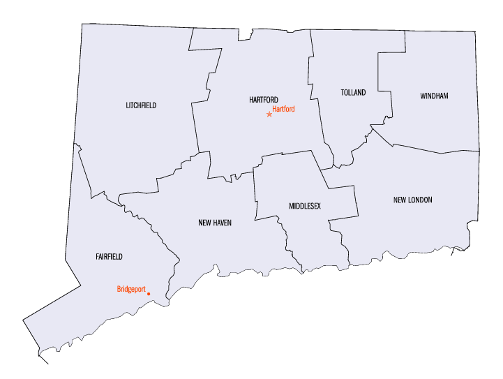
Connecticut-counties-map.gif (721 × 543 پکسل، فائل کا حجم: 14 کلوبائٹ، MIME قسم: image/gif)

|
This locator map image could be re-created using vector graphics as an SVG file. This has several advantages; see Commons:Media for cleanup for more information. If an SVG form of this image is available, please upload it and afterwards replace this template with
{{vector version available|new image name}}.
It is recommended to name the SVG file “Connecticut-counties-map.svg”—then the template Vector version available (or Vva) does not need the new image name parameter. |
خلاصہ
| تفصیل | The image was downloaded from en.wiki (en:Image:Connecticut-counties-map.gif) under the {{PD-USGov}} license tag. Wars 05:30, 12 September 2006 (UTC) | ||||||
| ماخذ | http://www.fedstats.go Archieved version | ||||||
| مصنف | Federal Committee on Statistical Methodology | ||||||
| اجازت (فائل کا دوبارہ استعمال) |
|
||||||

اجازہ کاری
| اس ملف کا لائسنس Creative Commons Attribution-Share Alike 3.0 Unported کے تحط ہے۔ Subject to disclaimers. | ||
| ||
| This licensing tag was added to this file as part of the GFDL licensing update. |

|
آپ کو آزاد سافٹ ویئر فاؤنڈیشن کی جانب سے شائع کردہ جی این یو آزاد مسوداتی اجازت نامہ کی شرائط استعمال کے تحت اس دستاویز کو نقل، تقسیم اور/ یا ترمیم کرنے کی اجازت دی جاتی ہے۔ اس اجازت نامہ کی ایک نقل 'جی این یو آزاد مسوداتی اجازت نامہ کے عنوان سے میسر ہے۔ Subject to disclaimers. |
فائل کا تاریخچہ
کسی خاص وقت یا تاریخ میں یہ فائل کیسی نظر آتی تھی، اسے دیکھنے کے لیے اس وقت/تاریخ پر کلک کریں۔
| تاریخ/وقت | تھمب نیل | ابعاد | صارف | تبصرہ | |
|---|---|---|---|---|---|
| رائج الوقت | 18:14، 15 مئی 2010ء | | 721 × 543 (14 کلوبائٹ) | DieBuche | fix |
| 05:25، 12 ستمبر 2006ء | تھمب نیل نہیں ہے | (16 کلوبائٹ) | Wars | The image was downloaded from en.wiki (en:Image:Connecticut-counties-map.gif) under the '''<nowiki>/nowiki<>''' license tag. ~~~~ |
روابط
درج ذیل صفحہ اس فائل کو استعمال کر رہا ہے:
فائل کا عالمی استعمال
مندرجہ ذیل ویکیوں میں یہ فائل زیر استعمال ہے:
- ar.wikipedia.org پر استعمال
- cy.wikipedia.org پر استعمال
- de.wikipedia.org پر استعمال
- en.wikipedia.org پر استعمال
- es.wikipedia.org پر استعمال
- fi.wikipedia.org پر استعمال
- frr.wikipedia.org پر استعمال
- fr.wikipedia.org پر استعمال
- he.wikipedia.org پر استعمال
- hu.wikipedia.org پر استعمال
- id.wikipedia.org پر استعمال
- it.wikipedia.org پر استعمال
- ja.wikipedia.org پر استعمال
- ko.wikipedia.org پر استعمال
- no.wikipedia.org پر استعمال
- pl.wikipedia.org پر استعمال
- pt.wikipedia.org پر استعمال
- ru.wikipedia.org پر استعمال
- simple.wikipedia.org پر استعمال
- sq.wikipedia.org پر استعمال
- sv.wikipedia.org پر استعمال
- zh.wikipedia.org پر استعمال