فائل:Durrës Pinargenti 1573.jpg
اس نمائش کا حجم: 800 × 592 پکسلز۔ دیگر تصمیمات: 320 × 237 پکسلز | 640 × 473 پکسلز | 1,024 × 757 پکسلز | 1,280 × 947 پکسلز | 2,016 × 1,491 پکسلز۔
اصل فائل (2,016 × 1,491 پکسل، فائل کا حجم: 3.2 MB، MIME قسم: image/jpeg)
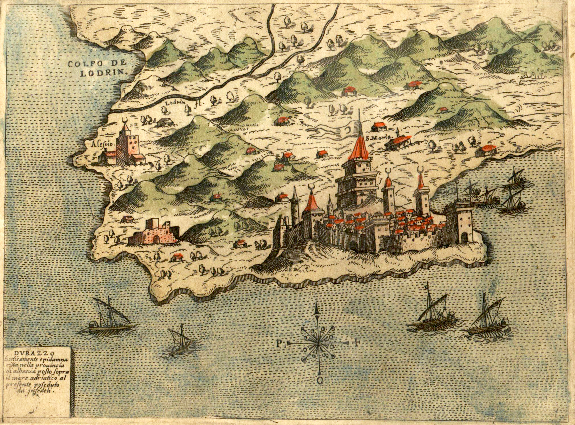
| تفصیل | Durrës enligt historisk karta, ritning av Simon Pinargenti 1573. | ||||
| تاریخ | |||||
| ماخذ | From Isole che son da Venetia nella Dalmatia et per tutto l'Arcipelago, fino a Costantinopoli, con le loro Fortezze e con le terre piu notabili di Dalmatia by Simon Pinargenti | ||||
| مصنف | Simon Pinargenti | ||||
| اجازت (فائل کا دوبارہ استعمال) |
|
||||
| دوسرے نسخے |
Originally from sv.wikipedia; description page is (was) here
|
||||
فائل کا تاریخچہ
کسی خاص وقت یا تاریخ میں یہ فائل کیسی نظر آتی تھی، اسے دیکھنے کے لیے اس وقت/تاریخ پر کلک کریں۔
| تاریخ/وقت | تھمب نیل | ابعاد | صارف | تبصرہ | |
|---|---|---|---|---|---|
| رائج الوقت | 17:37، 18 دسمبر 2018ء | | 2,016 × 1,491 (3.2 MB) | Actia Nicopolis | Better image |
| 13:12، 18 اگست 2007ء |  | 599 × 442 (131 کلوبائٹ) | Talgraf777 | ||
| 13:03، 21 جون 2007ء |  | 638 × 485 (85 کلوبائٹ) | Lokal Profil | {{Information |Description=Durrës enligt historisk karta, ritning av Simon Pinargenti 1573. |Source=From ''Isole che son da Venetia nella Dalmatia et per tutto l'Arcipelago, fino a Costantinopoli, con le loro Fortezze e con le terre piu notabili di Dalma |
روابط
درج ذیل صفحہ اس فائل کو استعمال کر رہا ہے:
فائل کا عالمی استعمال
مندرجہ ذیل ویکیوں میں یہ فائل زیر استعمال ہے:
- ar.wikipedia.org پر استعمال
- de.wikipedia.org پر استعمال
- el.wikipedia.org پر استعمال
- en.wikipedia.org پر استعمال
- fr.wikipedia.org پر استعمال
- gl.wikipedia.org پر استعمال
- he.wikipedia.org پر استعمال
- hr.wikipedia.org پر استعمال
- it.wikipedia.org پر استعمال
- lt.wikipedia.org پر استعمال
- mn.wikipedia.org پر استعمال
- nl.wikipedia.org پر استعمال
- pl.wikipedia.org پر استعمال
- pnb.wikipedia.org پر استعمال
- pt.wikipedia.org پر استعمال
- ru.wikipedia.org پر استعمال
- sco.wikipedia.org پر استعمال
- sh.wikipedia.org پر استعمال
- sl.wikipedia.org پر استعمال
- sq.wikipedia.org پر استعمال
- sr.wikipedia.org پر استعمال
- sv.wikipedia.org پر استعمال
- tr.wikipedia.org پر استعمال
- uk.wikipedia.org پر استعمال