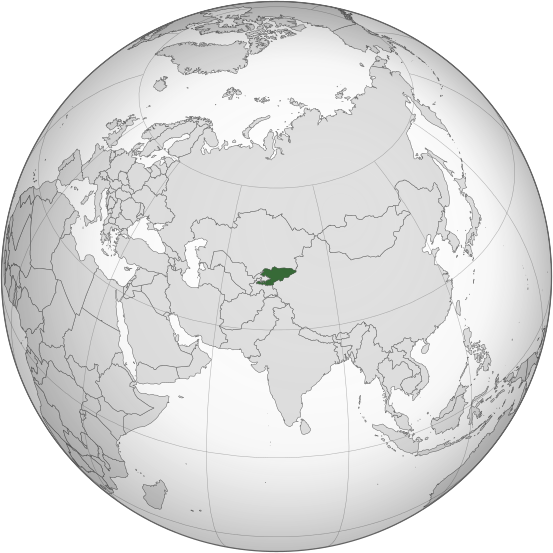
فائل:Kyrgyzstan (orthographic projection).svg

اس SVG فائل کی PNG نمائش کا حجم: 553 × 553 پکسلز دیگر تصمیمات: 240 × 240 پکسلز | 480 × 480 پکسلز | 768 × 768 پکسلز | 1,024 × 1,024 پکسلز | 2,048 × 2,048 پکسلز۔
اصل فائل (ایس وی جی فائل، ابعاد 553 × 553 پکسل، فائل کا حجم: 346 کلوبائٹ)
فائل کا تاریخچہ
کسی خاص وقت یا تاریخ میں یہ فائل کیسی نظر آتی تھی، اسے دیکھنے کے لیے اس وقت/تاریخ پر کلک کریں۔
| تاریخ/وقت | تھمب نیل | ابعاد | صارف | تبصرہ | |
|---|---|---|---|---|---|
| رائج الوقت | 01:08، 31 جولائی 2023ء |  | 553 × 553 (346 کلوبائٹ) | Cutlass | rv sock edits |
| 16:09، 6 جون 2023ء |  | 553 × 553 (310 کلوبائٹ) | Cutlerys | Reverted to version as of 12:34, 4 August 2013 (UTC) | |
| 16:08، 6 جون 2023ء |  | 553 × 553 (306 کلوبائٹ) | Cutlerys | Reverted to version as of 23:39, 16 March 2015 (UTC) | |
| 18:17، 1 مئی 2016ء |  | 553 × 553 (346 کلوبائٹ) | Nicolay Sidorov | ... | |
| 23:39، 16 مارچ 2015ء |  | 553 × 553 (306 کلوبائٹ) | Flappiefh | Removed Somaliland and Kosovo. Separated Western Sahara and Morroco. | |
| 12:34، 4 اگست 2013ء |  | 553 × 553 (310 کلوبائٹ) | Flappiefh | Added South Sudan. The map is now centered on Kyrgyzstan. | |
| 16:02، 9 جولائی 2012ء |  | 550 × 550 (490 کلوبائٹ) | Hariboneagle927 |
روابط
درج ذیل 2 صفحات اس فائل کو استعمال کر رہے ہیں:
فائل کا عالمی استعمال
مندرجہ ذیل ویکیوں میں یہ فائل زیر استعمال ہے:
- ady.wikipedia.org پر استعمال
- af.wikipedia.org پر استعمال
- ami.wikipedia.org پر استعمال
- ar.wikipedia.org پر استعمال
- arz.wikipedia.org پر استعمال
- ast.wikipedia.org پر استعمال
- as.wikipedia.org پر استعمال
- av.wikipedia.org پر استعمال
- azb.wikipedia.org پر استعمال
- bcl.wikipedia.org پر استعمال
- bg.wikipedia.org پر استعمال
- bh.wikipedia.org پر استعمال
- bi.wikipedia.org پر استعمال
- blk.wikipedia.org پر استعمال
- bn.wikipedia.org پر استعمال
- ca.wikipedia.org پر استعمال
- cdo.wikipedia.org پر استعمال
- ceb.wikipedia.org پر استعمال
- cs.wikipedia.org پر استعمال
- cy.wikipedia.org پر استعمال
- dag.wikipedia.org پر استعمال
- da.wikipedia.org پر استعمال
- de.wikivoyage.org پر استعمال
- diq.wikipedia.org پر استعمال
- el.wikipedia.org پر استعمال
- en.wikipedia.org پر استعمال
- en.wikinews.org پر استعمال
- eo.wikipedia.org پر استعمال
- es.wikipedia.org پر استعمال
- fa.wikipedia.org پر استعمال
- fi.wikipedia.org پر استعمال
- fo.wikipedia.org پر استعمال
- frr.wikipedia.org پر استعمال
اس فائل کا مزید عالمی استعمال دیکھیے۔
