فائل:Lori.svg

اس SVG فائل کی PNG نمائش کا حجم: 587 × 599 پکسلز دیگر تصمیمات: 235 × 240 پکسلز | 470 × 480 پکسلز | 752 × 768 پکسلز | 1,003 × 1,024 پکسلز | 2,006 × 2,048 پکسلز | 725 × 740 پکسلز۔
اصل فائل (ایس وی جی فائل، ابعاد 725 × 740 پکسل، فائل کا حجم: 72 کلوبائٹ)
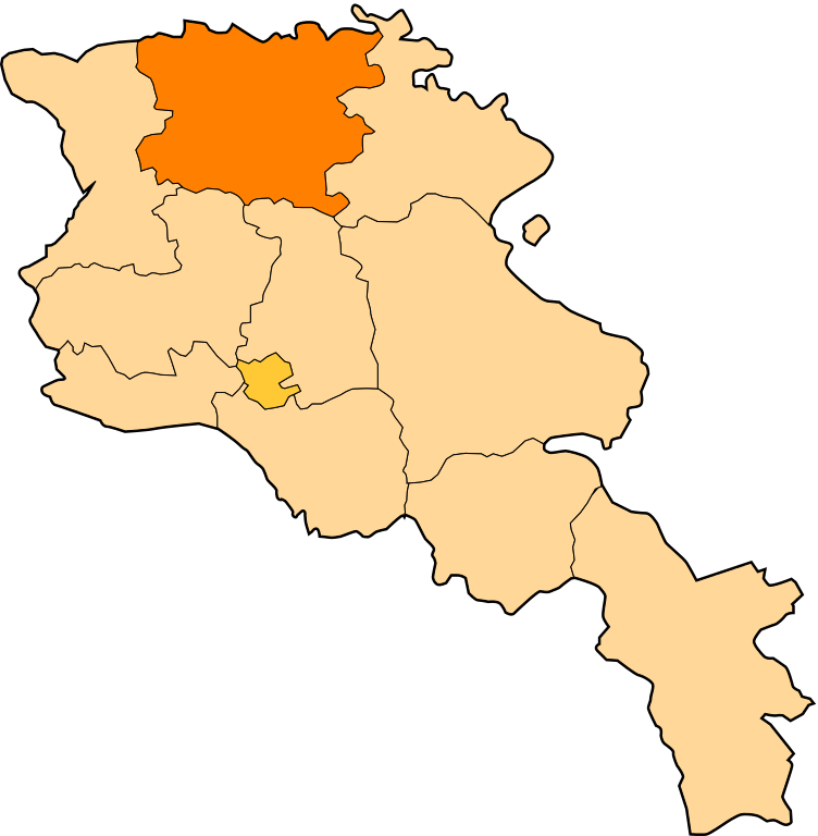
| تفصیل | Image shows the eleven administrative subdivisions of Armenia: # Aragatsotn (Արագածոտնի) # Ararat (Արարատի) # Armavir (Արմավիրի) # Gegharkunik (Գեղարքունիքի) # Kotayk (Կոտայքի) # Lori (Լոռու) # Shirak (Շիրակի) # Syunik (Սյունիքի) # Tavush (Տավուշի) # Vayots Dzor (Վայոց Ձորի) # Yerevan (Երևան) - special administrative status Derived from a multiple of public sources and created using Inkscape. == |
| تاریخ | (UTC) |
| ماخذ | |
| مصنف |
|
| This is a retouched picture, which means that it has been digitally altered from its original version. Modifications: Creation d'une autre map. The original can be viewed here: Armenia map numbered.svg:
|
اس ملف کا لائسنس Creative Commons Attribution-Share Alike 3.0 Unported کے تحط ہے۔
- آپ آزاد ہیں:
- شیئر کرنے – کام کو نقل، تقسیم یا منتقل کرنے کے لیے
- ریمکس کے لیے – کام منبطق کرنے کے لیے
- مندرجہ ذیل شرائط کے تحت:
- انتساب – آپ کو اس کام کا انتساب مصنف یا اجازت دہندہ کے بتائے گئے طریقہ کے مطابق دینا ہوگا (تاہم یہ انتساب اس طرح نہیں ہونا چاہیے کہ اسے دیکھ کر ایسا محسوس ہو کہ اصل مصنف یا اجازت دہندہ آپ کے یا آپ کے ذریعہ اس کام کے استعمال کرنے کے حامی ہیں)۔
- یکساں شراکت – اگر آپ اس کام میں کوئی تبدیلی یا ترمیم کرتے ہیں یا اس کام پر مبنی کچھ نیا بناتے ہیں تو اسے بھی آپ اسی یا اس جیسے کسی اجازت نامے کے تحت شائع کر سکتے ہیں۔
اولین اپلوڈ کا نوشتہ
This image is a derivative work of the following images:
- File:Armenia_map_numbered.svg licensed with Cc-by-sa-3.0-migrated, GFDL
- 2010-09-26T17:27:10Z 6AND5 725x740 (82221 Bytes) Reverted to version as of 17:31, 25 November 2006 (((Exclaves deleted according to official map at http://www.gov.am/en/regions/)))
- 2006-11-25T19:37:43Z Bastique 725x740 (87638 Bytes) Cleanup
- 2006-11-25T19:26:57Z Bastique 725x740 (86083 Bytes) Enclaves
- 2006-11-25T17:31:38Z Bastique 725x740 (82221 Bytes) Fixed canvas size
- 2006-11-25T17:27:59Z Bastique 744x1052 (79767 Bytes) Image shows the subdivisions of Armenia. Derived from a multiple of public sources and created using Inkscape. == Licensing == {{GFDL}} Image shows the eleven administrative subdivisions of Armenia: #[[Aragatsotn]] (Ար�
Uploaded with derivativeFX
فائل کا تاریخچہ
کسی خاص وقت یا تاریخ میں یہ فائل کیسی نظر آتی تھی، اسے دیکھنے کے لیے اس وقت/تاریخ پر کلک کریں۔
| تاریخ/وقت | تھمب نیل | ابعاد | صارف | تبصرہ | |
|---|---|---|---|---|---|
| رائج الوقت | 11:28، 30 دسمبر 2010ء | | 725 × 740 (72 کلوبائٹ) | Varmin | {{Information |Description=Image shows the eleven administrative subdivisions of Armenia: # Aragatsotn (Արագածոտնի) # Ararat (Արարատի) # Armavir (Արմավիրի) # Gegharkunik (Գեղ |
روابط
درج ذیل صفحہ اس فائل کو استعمال کر رہا ہے:
فائل کا عالمی استعمال
مندرجہ ذیل ویکیوں میں یہ فائل زیر استعمال ہے:
- ar.wikipedia.org پر استعمال
- be.wikipedia.org پر استعمال
- bg.wikipedia.org پر استعمال
- ceb.wikipedia.org پر استعمال
- ce.wikipedia.org پر استعمال
- Акнер
- Бендик
- Арманис
- Агарак (Лорин провинци)
- Азнвадзор
- Атан
- Ахнидзор
- Амракиц
- Айгеат
- Антарамут
- Апавен
- Ардви
- Арцни
- Ахтала (Лорин провинци)
- Арчут
- Арчут (станци)
- Аревацаг
- Аревашох
- Акори
- Базум
- Благодарни (Эрмалойчоь)
- Бовадзор
- Гаргар
- Гегасар
- Гюлагарак
- Гогаран
- Гугарк
- Дарпас
- Дебет
- Дсех
- Ехегнут
- Техут (Лорин провинци)
- Леджан
- Лернаовит
- Лернанцк
- Лернапат
- Лернаван
- Лермонтов (Лорин провинци)
اس فائل کا مزید عالمی استعمال دیکھیے۔