فائل:Map of Baluchistan from The Imperial Gazetteer of India (1907-1909).jpg
اس نمائش کا حجم: 710 × 599 پکسلز۔ دیگر تصمیمات: 284 × 240 پکسلز | 569 × 480 پکسلز | 1,000 × 844 پکسلز۔
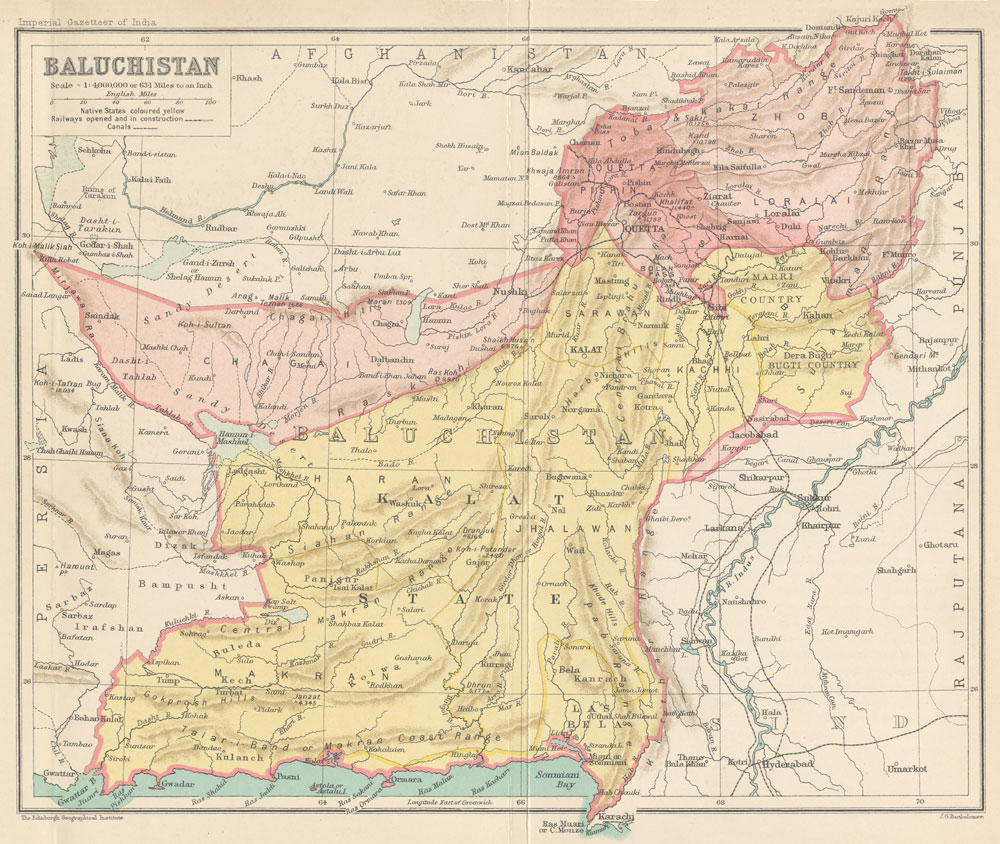
اصل فائل (1,000 × 844 پکسل، فائل کا حجم: 254 کلوبائٹ، MIME قسم: image/jpeg)
خلاصہ
| تفصیل |
English: Map of Baluchistan from The Imperial Gazetteer of India Volume 6, opposite page 336.. New edition, published under the authority of His Majesty's Secretary of State for India in Council. Oxford: Clarendon Press, 1907-1909.
Scale: 1:6,000,000. 1 in. to 94.6 miles. Native States colored yellow. |
| تاریخ | بین 1,907.0 و 1,909.0 |
| ماخذ | http://dsal.uchicago.edu/maps/gazetteer/index.html |
| مصنف | John G. Bartholomew |
| دوسرے نسخے |

.jpg)
اجازہ کاری
The author died in 1920, so this work is in the public domain in its country of origin and other countries and areas where the copyright term is the author's life plus 100 years or fewer. | |
| This file has been identified as being free of known restrictions under copyright law, including all related and neighboring rights. | |
فائل کا تاریخچہ
کسی خاص وقت یا تاریخ میں یہ فائل کیسی نظر آتی تھی، اسے دیکھنے کے لیے اس وقت/تاریخ پر کلک کریں۔
| تاریخ/وقت | تھمب نیل | ابعاد | صارف | تبصرہ | |
|---|---|---|---|---|---|
| رائج الوقت | 06:19، 8 اکتوبر 2014ء | | 1,000 × 844 (254 کلوبائٹ) | Co9man | User created page with UploadWizard |
روابط
درج ذیل صفحہ اس فائل کو استعمال کر رہا ہے:
فائل کا عالمی استعمال
مندرجہ ذیل ویکیوں میں یہ فائل زیر استعمال ہے:
- bn.wikipedia.org پر استعمال
- ca.wikipedia.org پر استعمال
- de.wikipedia.org پر استعمال
- en.wikipedia.org پر استعمال
- es.wikipedia.org پر استعمال
- fa.wikipedia.org پر استعمال
- hi.wikipedia.org پر استعمال
- hu.wikipedia.org پر استعمال
- it.wikipedia.org پر استعمال
- mr.wikipedia.org پر استعمال
- pl.wikipedia.org پر استعمال
- ru.wikipedia.org پر استعمال
.jpg)