فائل:Pichincha.png
اس نمائش کا حجم: 800 × 534 پکسلز۔ دیگر تصمیمات: 320 × 214 پکسلز | 640 × 427 پکسلز | 1,024 × 684 پکسلز | 1,280 × 855 پکسلز | 1,920 × 1,282 پکسلز۔
اصل فائل (1,920 × 1,282 پکسل، فائل کا حجم: 96 کلوبائٹ، MIME قسم: image/png)
خلاصہ
| تفصیل |
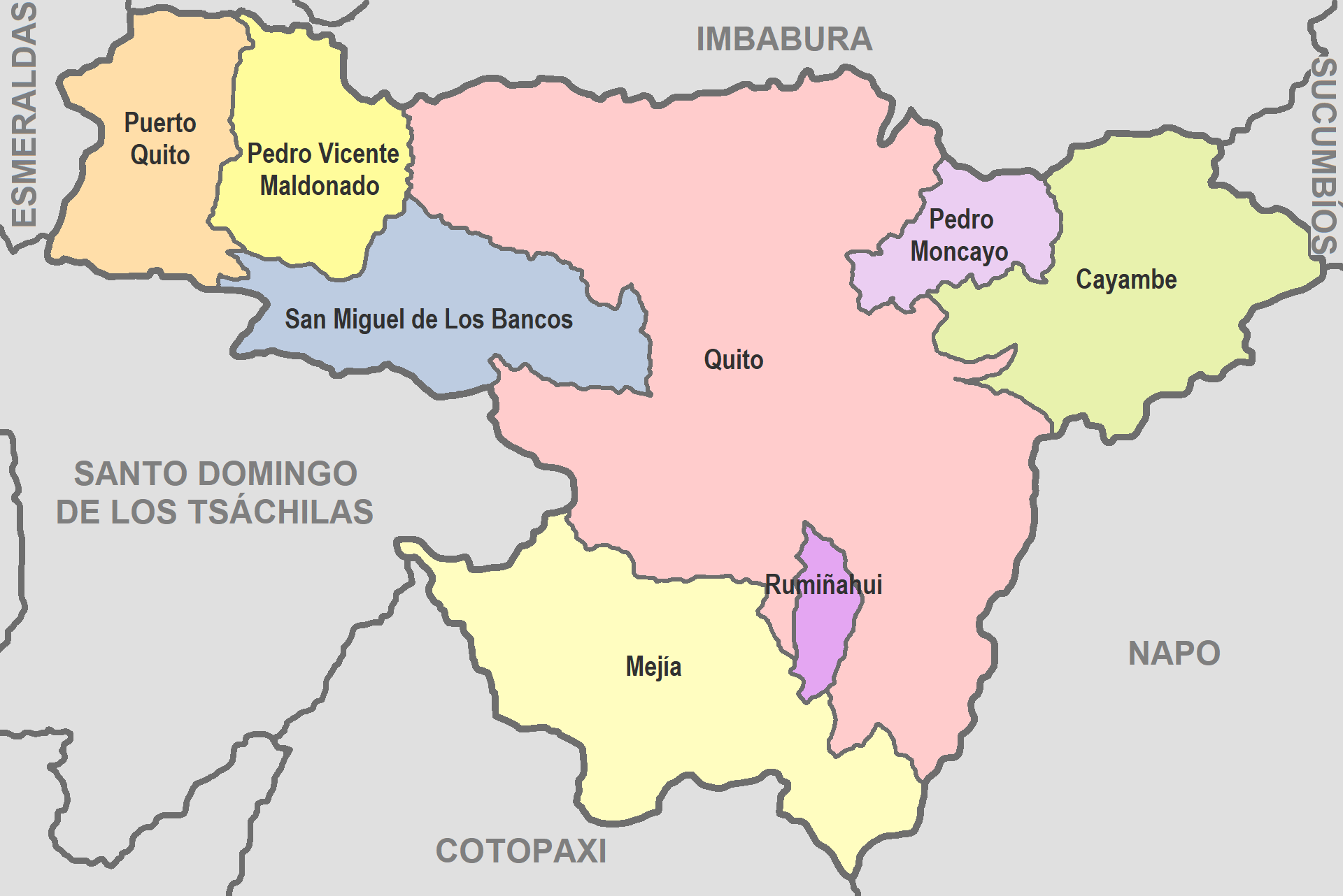
English: Map of Pichincha
Español: Mapa de Pichincha |
| تاریخ | |
| ماخذ | De mi trabajo |
| مصنف | David C. S. |
اجازہ کاری
میں اس تخلیقی کام کے حقوق کا مالک ہوں اور اسے مندرجہ ذیل اجازت نامے کے تحت شائع کرتا ہوں:
| This file is made available under the Creative Commons CC0 1.0 Universal Public Domain Dedication. | |
| The person who associated a work with this deed has dedicated the work to the public domain by waiving all of their rights to the work worldwide under copyright law, including all related and neighboring rights, to the extent allowed by law. You can copy, modify, distribute and perform the work, even for commercial purposes, all without asking permission.
|
فائل کا تاریخچہ
کسی خاص وقت یا تاریخ میں یہ فائل کیسی نظر آتی تھی، اسے دیکھنے کے لیے اس وقت/تاریخ پر کلک کریں۔
| تاریخ/وقت | تھمب نیل | ابعاد | صارف | تبصرہ | |
|---|---|---|---|---|---|
| رائج الوقت | 03:32، 14 جون 2022ء | | 1,920 × 1,282 (96 کلوبائٹ) | David C. S. | Imagen |
| 04:07، 26 ستمبر 2017ء |  | 707 × 457 (37 کلوبائٹ) | Berposen | Actualizando los limites de la provincia de Santo Domingo de los Tsachilas. | |
| 21:16، 10 اکتوبر 2011ء |  | 707 × 457 (33 کلوبائٹ) | David C. S. | Imagen | |
| 23:52، 6 اپریل 2011ء |  | 601 × 384 (39 کلوبائٹ) | David C. S. | {{Information |Description ={{en|1=Map of Pichincha}} {{es|1=Mapa de Pichincha}} |Source =De mi trabajo |Author =David C. S. |Date =2011-04-03 |Permission = |other_versions = }} |
روابط
اس فائل سے مربوط کوئی صفحہ موجود نہیں ہے۔