فائل:Poland 1956-1990.svg

اس SVG فائل کی PNG نمائش کا حجم: 450 × 456 پکسلز دیگر تصمیمات: 237 × 240 پکسلز | 474 × 480 پکسلز | 758 × 768 پکسلز | 1,011 × 1,024 پکسلز | 2,021 × 2,048 پکسلز۔
اصل فائل (ایس وی جی فائل، ابعاد 450 × 456 پکسل، فائل کا حجم: 474 کلوبائٹ)
خلاصہ


.svg)
.svg)
.svg)
.svg)
.svg)


.svg)
.svg)
.svg)


.png)
.png)


.svg)


.svg)

.svg)


.svg)
.svg)
.svg)
.svg)


.svg)
.png)


.svg)


.svg)
.svg)


.svg)


.svg)


.svg)
.svg)
.svg)
.svg)
.svg)
.svg)
.svg)
_cropped.svg)
.svg)
.svg)
.svg)
.svg)
.svg)
.svg)
.svg)
.svg)
.svg)
.svg)
.svg)
.svg)
.svg)
.svg)
.svg)
.svg)
.svg)
.svg)
.svg)
.svg)
.svg)
.svg)
.svg)
.svg)
.svg)
.svg)
.svg)
.svg)
.svg)
.svg)
.svg)
.svg)
.svg)
.svg)
.svg)
.svg)
.svg)
.svg)
.svg)
.svg)
.svg)
.svg)
.svg)
.svg)
.svg)
| This is a retouched picture, which means that it has been digitally altered from its original version. The original can be viewed here: Blank map of Europe 1956-1990.svg:
|
اجازہ کاری
میں اس تخلیقی کام کے حقوق کا مالک ہوں اور اسے مندرجہ ذیل اجازت نامے کے تحت شائع کرتا ہوں:
اس ملف کا لائسنس Creative Commons Attribution-Share Alike 3.0 Unported کے تحط ہے۔
- آپ آزاد ہیں:
- شیئر کرنے – کام کو نقل، تقسیم یا منتقل کرنے کے لیے
- ریمکس کے لیے – کام منبطق کرنے کے لیے
- مندرجہ ذیل شرائط کے تحت:
- انتساب – آپ کو اس کام کا انتساب مصنف یا اجازت دہندہ کے بتائے گئے طریقہ کے مطابق دینا ہوگا (تاہم یہ انتساب اس طرح نہیں ہونا چاہیے کہ اسے دیکھ کر ایسا محسوس ہو کہ اصل مصنف یا اجازت دہندہ آپ کے یا آپ کے ذریعہ اس کام کے استعمال کرنے کے حامی ہیں)۔
- یکساں شراکت – اگر آپ اس کام میں کوئی تبدیلی یا ترمیم کرتے ہیں یا اس کام پر مبنی کچھ نیا بناتے ہیں تو اسے بھی آپ اسی یا اس جیسے کسی اجازت نامے کے تحت شائع کر سکتے ہیں۔
اولین اپلوڈ کا نوشتہ
This image is a derivative work of the following images:
- File:Blank_map_of_Europe_1956-1990.svg licensed with Cc-by-sa-3.0
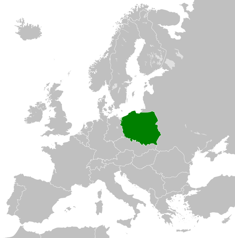
- 2011-10-30T04:43:42Z Alphathon 450x456 (485146 Bytes) == {{int:filedesc}} == {{Information |Description={{en|Blank map of Europe showing national borders as they stood from 1956-1990.}} |Source=*[[:File:Blank_map_of_Europe.svg|]] |Date=2011-10-30 04:42 (UTC) |Author=*[[:File:Bla
Uploaded with derivativeFX
فائل کا تاریخچہ
کسی خاص وقت یا تاریخ میں یہ فائل کیسی نظر آتی تھی، اسے دیکھنے کے لیے اس وقت/تاریخ پر کلک کریں۔
| تاریخ/وقت | تھمب نیل | ابعاد | صارف | تبصرہ | |
|---|---|---|---|---|---|
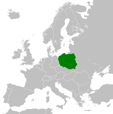
| رائج الوقت | 00:23، 26 نومبر 2011ء | | 450 × 456 (474 کلوبائٹ) | StalwartUK | == {{int:filedesc}} == {{Information |Description={{en|Map of the People's Republic of Poland as it was from 1945-1990. Surrounding countries accurate from 1956-1990.}} |Source=*[[:File:Blank_map_of_Europe_1956-1990.svg |
روابط
درج ذیل صفحہ اس فائل کو استعمال کر رہا ہے:
فائل کا عالمی استعمال
مندرجہ ذیل ویکیوں میں یہ فائل زیر استعمال ہے:
- an.wikipedia.org پر استعمال
- ar.wikipedia.org پر استعمال
- az.wikipedia.org پر استعمال
- ca.wikipedia.org پر استعمال
- cs.wikipedia.org پر استعمال
- de.wikipedia.org پر استعمال
- el.wikipedia.org پر استعمال
- en.wikipedia.org پر استعمال
- en.wiktionary.org پر استعمال
- eo.wikipedia.org پر استعمال
- es.wikipedia.org پر استعمال
- et.wikipedia.org پر استعمال
- eu.wikipedia.org پر استعمال
- fa.wikipedia.org پر استعمال
- fi.wikipedia.org پر استعمال
- fr.wikipedia.org پر استعمال
- gl.wikipedia.org پر استعمال
- he.wikipedia.org پر استعمال
- hi.wikipedia.org پر استعمال
- hu.wikipedia.org پر استعمال
- hy.wikipedia.org پر استعمال
- id.wikipedia.org پر استعمال
- it.wikipedia.org پر استعمال
- ja.wikipedia.org پر استعمال
- kk.wikipedia.org پر استعمال
- ko.wikipedia.org پر استعمال
- lt.wikipedia.org پر استعمال
- lv.wikipedia.org پر استعمال
- mk.wikipedia.org پر استعمال
- ms.wikipedia.org پر استعمال
- nl.wikipedia.org پر استعمال
- pl.wikipedia.org پر استعمال
- Rzeczpospolita Polska
- Polska Rzeczpospolita Ludowa
- Wikipedysta:KrakovHD/brudnopis
- Wikipedysta:OlafMaj1/brudnopi4
- Wikipedysta:TheTNT1500/Lista państw komunistycznych
- Wikipedysta:Malarz pl/szablony/Państwo infobox/4
- Wikipedysta:Malarz pl/szablony/Państwo infobox
- Wikipedysta:Malarz pl/szablony/Państwo infobox/26
- pnb.wikipedia.org پر استعمال
- pt.wikipedia.org پر استعمال
- ro.wikipedia.org پر استعمال
اس فائل کا مزید عالمی استعمال دیکھیے۔