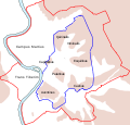
فائل:Roma Plan.jpg

اس نمائش کا حجم: 754 × 600 پکسلز۔ دیگر تصمیمات: 302 × 240 پکسلز | 604 × 480 پکسلز | 966 × 768 پکسلز | 1,280 × 1,018 پکسلز | 1,840 × 1,463 پکسلز۔
اصل فائل (1,840 × 1,463 پکسل، فائل کا حجم: 2.5 MB، MIME قسم: image/jpeg)
فائل کا تاریخچہ
کسی خاص وقت یا تاریخ میں یہ فائل کیسی نظر آتی تھی، اسے دیکھنے کے لیے اس وقت/تاریخ پر کلک کریں۔
| تاریخ/وقت | تھمب نیل | ابعاد | صارف | تبصرہ | |
|---|---|---|---|---|---|
| رائج الوقت | 16:14، 30 مارچ 2015ء |  | 1,840 × 1,463 (2.5 MB) | Jonstevn | Reverted to version as of 19:01, 28 August 2006 |
| 16:10، 30 مارچ 2015ء |  | 1,840 × 1,463 (2.5 MB) | Jonstevn | Reverted to version as of 19:01, 28 August 2006 | |
| 16:10، 30 مارچ 2015ء |  | 1,840 × 1,463 (2.5 MB) | Jonstevn | Reverted to version as of 19:01, 28 August 2006 | |
| 06:40، 27 جولائی 2008ء |  | 1,840 × 1,463 (3.38 MB) | Amadscientist | {{Information |Description= |Source= |Date= |Author= |Permission= |other_versions= }} | |
| 04:57، 27 جولائی 2008ء |  | 4,000 × 3,180 (12.21 MB) | Amadscientist | {{Information |Description= |Source= |Date= |Author= |Permission= |other_versions= }} | |
| 19:01، 28 اگست 2006ء |  | 1,840 × 1,463 (2.5 MB) | Nikephoros | {{Information |Description=Plan Roms im Altertum / Map of Rome during Antiquity |Source=G. Droysens Allgemeiner Historischer Handatlas |Date=1886 |Author=? |Permission= not needed |other_versions= no }} |
روابط
درج ذیل 33 صفحات اس فائل کو استعمال کر رہے ہیں:
- اوریلیان دیواریں
- جینیکولم دیواریں
- رومی فورم
- قلعہ سانت اینجلو
- لارگو دی تورے ارجنٹینا
- محراب دولابیلا
- محراب گالیئنوس
- مقبرہ آگسٹس
- پورتا آردیاتینا
- پورتا آسیناریا
- پورتا ایسکویلینا
- پورتا تیبورتینا
- پورتا دل پوپولو
- پورتا سان سیباستیانو
- پورتا سان پانکرازیو
- پورتا سان پاولو
- پورتا سانتو سپیریتو
- پورتا سیتیمیانا
- پورتا لاتینا
- پورتا ماجیورے
- پورتا میترونیا
- پورتا نومینتانا
- پورتا پنچانا
- پورتا پورتیسے
- پورتا پیا
- پورتا پیرتوسا
- پورتا کاوالیجیری
- پورتا کایلیمونتانا
- پورتونوس کا مندر
- پینتھیون، روم
- کاسترا پریتوریا
- سانچہ:Ancient monuments in Rome
- سانچہ:Location map Italy Rome Antiquity
فائل کا عالمی استعمال
مندرجہ ذیل ویکیوں میں یہ فائل زیر استعمال ہے:
- ar.wikipedia.org پر استعمال
- as.wikipedia.org پر استعمال
- azb.wikipedia.org پر استعمال
- beta.wikiversity.org پر استعمال
- bg.wikipedia.org پر استعمال
- bn.wikipedia.org پر استعمال
- bs.wikipedia.org پر استعمال
- bxr.wikipedia.org پر استعمال
- ca.wikipedia.org پر استعمال
- ceb.wikipedia.org پر استعمال
- cs.wikipedia.org پر استعمال
اس فائل کا مزید عالمی استعمال دیکھیے۔


