فائل:Somaliland map.png
اس سے زیادہ ریزولیوشن دستیاب نہیں۔
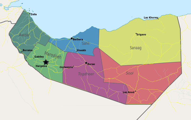
Somaliland_map.png (800 × 504 پکسل، فائل کا حجم: 99 کلوبائٹ، MIME قسم: image/png)
خلاصہ
| تفصیل | Map of Somaliland. |
| تاریخ | |
| ماخذ | ذاتی کام |
| مصنف | PANONIAN |
اجازہ کاری
میں اس تخلیقی کام کے حقوق کا مالک ہوں اور اسے مندرجہ ذیل اجازت نامے کے تحت شائع کرتا ہوں:
| This file is made available under the Creative Commons CC0 1.0 Universal Public Domain Dedication. | |
| The person who associated a work with this deed has dedicated the work to the public domain by waiving all of their rights to the work worldwide under copyright law, including all related and neighboring rights, to the extent allowed by law. You can copy, modify, distribute and perform the work, even for commercial purposes, all without asking permission.
|
References
- http://www.sdo.nu/wp-content/uploads/2010/04/map-vd-steden1.gif
- http://www.somaliland.org/images/i/map_somaliland_org.gif
- http://www.somaliland.org/images/b/2007/11/map_somaliland.gif
- http://images.wikia.com/turtledove/images/c/c7/SomalilandMap.jpg
- http://xarbi.files.wordpress.com/2010/11/somaliland-map-in-ai.jpg
- http://cdn-english.alshahid.net/wp-content/uploads/2010/02/somland.jpg?59dea9
- http://www.tothepointnews.com/images/stories/2011/somaliland_map.jpg
- http://xarbi.files.wordpress.com/2010/04/somaliland-map22.jpg
- http://xarbi.files.wordpress.com/2010/05/somaliland-map-20101.jpg
- http://www.afrol.com/images/maps/somaliland_big.gif
فائل کا تاریخچہ
کسی خاص وقت یا تاریخ میں یہ فائل کیسی نظر آتی تھی، اسے دیکھنے کے لیے اس وقت/تاریخ پر کلک کریں۔
| تاریخ/وقت | تھمب نیل | ابعاد | صارف | تبصرہ | |
|---|---|---|---|---|---|
| رائج الوقت | 11:55، 10 مئی 2021ء | | 800 × 504 (99 کلوبائٹ) | Siirski | Update |
| 18:04، 20 جون 2020ء |  | 1,254 × 741 (42 کلوبائٹ) | Chipmunkdavis | Reverted to version as of 14:41, 2 July 2012 (UTC) Rv unlablled change. The only labelled place is controlled by Somaliland. | |
| 20:31، 17 جون 2020ء |  | 800 × 473 (64 کلوبائٹ) | Meelpringthusss | clearer color | |
| 02:12، 16 جون 2020ء |  | 800 × 473 (64 کلوبائٹ) | Meelpringthusss | added disputed areas | |
| 14:41، 2 جولائی 2012ء |  | 1,254 × 741 (42 کلوبائٹ) | PANONIAN | {{Information |Description=Map of Somaliland. |Source={{own}} |Date=2012 |Author= PANONIAN |Permission= |other_versions= }} |
روابط
درج ذیل صفحہ اس فائل کو استعمال کر رہا ہے:
فائل کا عالمی استعمال
مندرجہ ذیل ویکیوں میں یہ فائل زیر استعمال ہے:
- arz.wikipedia.org پر استعمال
- be.wikipedia.org پر استعمال
- bn.wikipedia.org پر استعمال
- bs.wikipedia.org پر استعمال
- ca.wikipedia.org پر استعمال
- crh.wikipedia.org پر استعمال
- dv.wikipedia.org پر استعمال
- ga.wikipedia.org پر استعمال
- hr.wikipedia.org پر استعمال
- hy.wikipedia.org پر استعمال
- incubator.wikimedia.org پر استعمال
- ms.wikipedia.org پر استعمال
- oc.wikipedia.org پر استعمال
- pam.wikipedia.org پر استعمال
- pnb.wikipedia.org پر استعمال
- sa.wikipedia.org پر استعمال
- sco.wikipedia.org پر استعمال
- sh.wikipedia.org پر استعمال
- sk.wikipedia.org پر استعمال
- so.wikipedia.org پر استعمال
- sr.wikipedia.org پر استعمال
- su.wikipedia.org پر استعمال
- ta.wikipedia.org پر استعمال
- tl.wikipedia.org پر استعمال
- tr.wikipedia.org پر استعمال
- xmf.wikipedia.org پر استعمال