فائل:Stanford-linear-accelerator-usgs-ortho-kaminski-5900.jpg
اس نمائش کا حجم: 800 × 201 پکسلز۔ دیگر تصمیمات: 320 × 80 پکسلز | 640 × 161 پکسلز | 1,024 × 257 پکسلز | 1,280 × 321 پکسلز | 5,900 × 1,480 پکسلز۔
اصل فائل (5,900 × 1,480 پکسل، فائل کا حجم: 1.88 MB، MIME قسم: image/jpeg)
خلاصہ
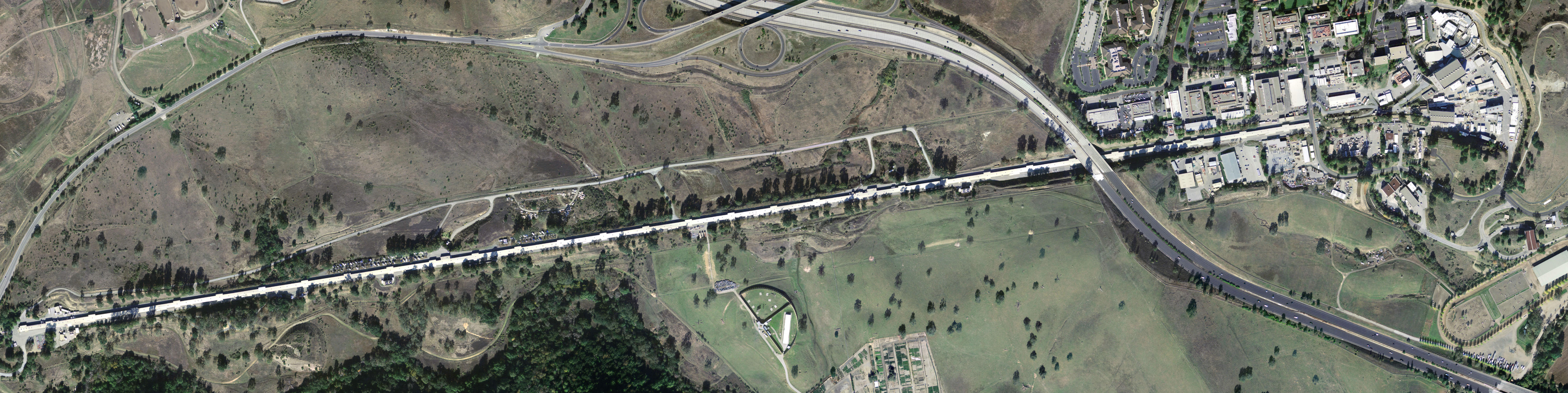
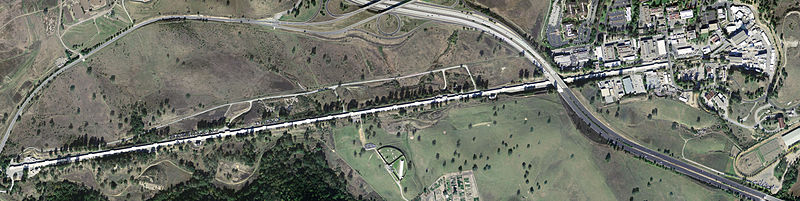
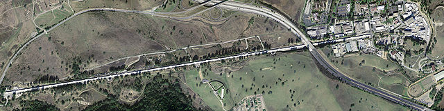
| تفصیل | Stanford Linear Accelerator, shown in an aerial digital orthoimage. The two roads seen near the accelerator are California Interstate 280 (to the East) and Sand Hill Road (along the Northwest). |
| تاریخ | |
| ماخذ | United States Geological Survey |
| مصنف | Peter Kaminski |
اجازہ کاری
This image is in the public domain in the United States because it only contains materials that originally came from the United States Geological Survey, an agency of the United States Department of the Interior. For more information, see the official USGS copyright policy.
|
فائل کا تاریخچہ
کسی خاص وقت یا تاریخ میں یہ فائل کیسی نظر آتی تھی، اسے دیکھنے کے لیے اس وقت/تاریخ پر کلک کریں۔
| تاریخ/وقت | تھمب نیل | ابعاد | صارف | تبصرہ | |
|---|---|---|---|---|---|
| رائج الوقت | 07:56، 8 مئی 2005ء | 5,900 × 1,480 (1.88 MB) | Floriang | Stanford Linear Accelerator, shown in an aerial digital orthoimage. Image data acquired 2004-02-27 by the United States Geological Survey. This image created by Peter Kaminski, 2004-12-19 and uploaded in the public domain. {{ |
روابط
درج ذیل صفحہ اس فائل کو استعمال کر رہا ہے:
فائل کا عالمی استعمال
مندرجہ ذیل ویکیوں میں یہ فائل زیر استعمال ہے:
- ar.wikipedia.org پر استعمال
- ca.wikipedia.org پر استعمال
- cs.wikipedia.org پر استعمال
- de.wikipedia.org پر استعمال
- en.wikipedia.org پر استعمال
- SLAC National Accelerator Laboratory
- Electron scattering
- John Duncan (artist)
- List of Historic Mechanical Engineering Landmarks
- Portal talk:California
- User:Cullen328/sandbox/Stanford
- User:IndianFace/sandbox
- Portal:San Francisco Bay Area/Years/Archive
- Portal:San Francisco Bay Area/Years/53
- Timeline of the San Francisco Bay Area
- en.wikibooks.org پر استعمال
- es.wikipedia.org پر استعمال
- fi.wikipedia.org پر استعمال
- fr.wikipedia.org پر استعمال
- hu.wikipedia.org پر استعمال
- it.wikipedia.org پر استعمال
- ja.wikipedia.org پر استعمال
- ko.wikipedia.org پر استعمال
- la.wikipedia.org پر استعمال
- lt.wikipedia.org پر استعمال
- nl.wikipedia.org پر استعمال
- nn.wikipedia.org پر استعمال
- pl.wikipedia.org پر استعمال
- pt.wikipedia.org پر استعمال
- ro.wikipedia.org پر استعمال
- ru.wikipedia.org پر استعمال
- sk.wikipedia.org پر استعمال
- sv.wikipedia.org پر استعمال
- tr.wikipedia.org پر استعمال
- uk.wikipedia.org پر استعمال