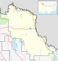
فائل:Australia Victoria Swan Hill Rural City location map.svg

اس SVG فائل کی PNG نمائش کا حجم: 535 × 561 پکسلز دیگر تصمیمات: 229 × 240 پکسلز | 458 × 480 پکسلز | 732 × 768 پکسلز | 977 × 1,024 پکسلز | 1,953 × 2,048 پکسلز۔
اصل فائل (ایس وی جی فائل، ابعاد 535 × 561 پکسل، فائل کا حجم: 580 کلوبائٹ)
فائل کا تاریخچہ
کسی خاص وقت یا تاریخ میں یہ فائل کیسی نظر آتی تھی، اسے دیکھنے کے لیے اس وقت/تاریخ پر کلک کریں۔
| تاریخ/وقت | تھمب نیل | ابعاد | صارف | تبصرہ | |
|---|---|---|---|---|---|
| رائج الوقت | 14:45، 18 فروری 2011ء |  | 535 × 561 (580 کلوبائٹ) | Cassowary | {{Information |Description ={{en|1=Blank map of w:Swan Hill Rural City, Victoria, Australia, with the following information shown: * LGA boundaries * Coastline, lakes and rivers * Highways and freeways * Urban areas * Parks Geographic limits: * No |
روابط
درج ذیل صفحہ اس فائل کو استعمال کر رہا ہے:
فائل کا عالمی استعمال
مندرجہ ذیل ویکیوں میں یہ فائل زیر استعمال ہے:
- ar.wikipedia.org پر استعمال
- ceb.wikipedia.org پر استعمال
- en.wikipedia.org پر استعمال
- Rural City of Swan Hill
- Boundary Bend, Victoria
- Robinvale
- Nyah West
- Manangatang
- Swan Hill
- Ultima, Victoria
- Woorinen South
- Lake Boga, Victoria
- Annuello, Victoria
- Bannerton, Victoria
- Beverford, Victoria
- Piangil
- Nyah, Victoria
- Wemen, Victoria
- Kooloonong
- Fish Point, Victoria
- Vinifera, Victoria
- Tol Tol
- Castle Donnington, Victoria
- Winnamboo
- Meatian
- Speewa, Victoria
- Liparoo
- Cocamba
- Waitchie
- Gowanford
- Chinkapook
- Gerahmin
- Chillingollah, Victoria
- Nowie, Victoria
- Murnungin
- Bolton, Victoria
- Kunat
- Pira, Victoria
- Chinangin
- Lake Powell, Victoria
- Natya, Victoria
- Tresco, Victoria
- Wandown
- Nyrraby
- Goschen, Victoria
- Template:Towns in the Rural City of Swan Hill
- Tyntynder
- Pental Island
- Module:Location map/data/Australia Victoria Rural City of Swan Hill/doc
- Happy Valley, Victoria
- Narrung, Victoria
اس فائل کا مزید عالمی استعمال دیکھیے۔
