فائل:Hinton St. Mary, parish church of St. Peter - geograph.org.uk - 513003.jpg
اس سے زیادہ ریزولیوشن دستیاب نہیں۔
Hinton_St._Mary,_parish_church_of_St._Peter_-_geograph.org.uk_-_513003.jpg (640 × 429 پکسل، فائل کا حجم: 76 کلوبائٹ، MIME قسم: image/jpeg)
خلاصہ
| تفصیل |
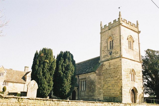
English: Hinton St. Mary: parish church of St. Peter As is true of many Dorset churches, this church has a 15th-century tower while the remainder was dates from the 19th in this case, 1846.
I do not know why the parish church of a village with St. Mary in its name should be dedicated to St. Peter thoughts welcomed! |
| تاریخ | |
| ماخذ | From geograph.org.uk |
| مصنف | Chris Downer |
| لگاؤ (required by the license) | Chris Downer / Hinton St. Mary: parish church of St. Peter / |
| Camera location | | View this and other nearby images on: OpenStreetMap |
|---|
_heading:135.00&language=ur)
| Object location | | View this and other nearby images on: OpenStreetMap |
|---|
_heading:135.00&language=ur)
اجازہ کاری

|
This image was taken from the Geograph project collection. See this photograph's page on the Geograph website for the photographer's contact details. The copyright on this image is owned by Chris Downer and is licensed for reuse under the Creative Commons Attribution-ShareAlike 2.0 license.
|
This file is licensed under the Creative Commons Attribution-Share Alike 2.0 Generic license.
لگاؤ: Chris Downer
- آپ آزاد ہیں:
- شیئر کرنے – کام کو نقل، تقسیم یا منتقل کرنے کے لیے
- ریمکس کے لیے – کام منبطق کرنے کے لیے
- مندرجہ ذیل شرائط کے تحت:
- انتساب – آپ کو اس کام کا انتساب مصنف یا اجازت دہندہ کے بتائے گئے طریقہ کے مطابق دینا ہوگا (تاہم یہ انتساب اس طرح نہیں ہونا چاہیے کہ اسے دیکھ کر ایسا محسوس ہو کہ اصل مصنف یا اجازت دہندہ آپ کے یا آپ کے ذریعہ اس کام کے استعمال کرنے کے حامی ہیں)۔
- یکساں شراکت – اگر آپ اس کام میں کوئی تبدیلی یا ترمیم کرتے ہیں یا اس کام پر مبنی کچھ نیا بناتے ہیں تو اسے بھی آپ اسی یا اس جیسے کسی اجازت نامے کے تحت شائع کر سکتے ہیں۔
فائل کا تاریخچہ
کسی خاص وقت یا تاریخ میں یہ فائل کیسی نظر آتی تھی، اسے دیکھنے کے لیے اس وقت/تاریخ پر کلک کریں۔
| تاریخ/وقت | تھمب نیل | ابعاد | صارف | تبصرہ | |
|---|---|---|---|---|---|
| رائج الوقت | 12:52، 5 فروری 2011ء | | 640 × 429 (76 کلوبائٹ) | GeographBot | == {{int:filedesc}} == {{Information |description={{en|1=Hinton St. Mary: parish church of St. Peter As is true of many Dorset churches, this church has a 15th-century tower while the remainder was dates from the 19th in this case, 1846. I do not kn |
روابط
درج ذیل صفحہ اس فائل کو استعمال کر رہا ہے:
فائل کا عالمی استعمال
مندرجہ ذیل ویکیوں میں یہ فائل زیر استعمال ہے:
- ceb.wikipedia.org پر استعمال
- cy.wikipedia.org پر استعمال
- en.wikipedia.org پر استعمال
- fa.wikipedia.org پر استعمال
- fr.wikipedia.org پر استعمال
- it.wikipedia.org پر استعمال
- lld.wikipedia.org پر استعمال
- nl.wikipedia.org پر استعمال
- pl.wikipedia.org پر استعمال
- www.wikidata.org پر استعمال