فائل:Holland-on-Sea, Beach at Sandy Point - geograph.org.uk - 1470929.jpg
اس سے زیادہ ریزولیوشن دستیاب نہیں۔
Holland-on-Sea,_Beach_at_Sandy_Point_-_geograph.org.uk_-_1470929.jpg (640 × 471 پکسل، فائل کا حجم: 61 کلوبائٹ، MIME قسم: image/jpeg)
خلاصہ
| تفصیل |
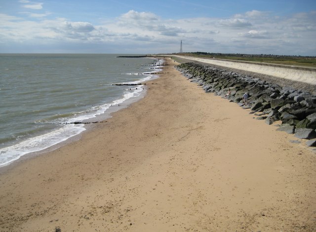
English: Holland-on-Sea: Beach at Sandy Point The boundary between Holland-on-Sea and Frinton-on-Sea lies just beyond the first groyne so this is the very north-eastern extremity of Holland-on-Sea. The tower on the horizon is the communications mast in TM2117. |
| تاریخ | |
| ماخذ | From geograph.org.uk |
| مصنف | Nigel Cox |
| لگاؤ (required by the license) | Nigel Cox / Holland-on-Sea: Beach at Sandy Point / |
| Camera location | | View this and other nearby images on: OpenStreetMap |
|---|
_heading:202.00&language=ur)
| Object location | | View this and other nearby images on: OpenStreetMap |
|---|
_heading:202.00&language=ur)
اجازہ کاری

|
This image was taken from the Geograph project collection. See this photograph's page on the Geograph website for the photographer's contact details. The copyright on this image is owned by Nigel Cox and is licensed for reuse under the Creative Commons Attribution-ShareAlike 2.0 license.
|
This file is licensed under the Creative Commons Attribution-Share Alike 2.0 Generic license.
لگاؤ: Nigel Cox
- آپ آزاد ہیں:
- شیئر کرنے – کام کو نقل، تقسیم یا منتقل کرنے کے لیے
- ریمکس کے لیے – کام منبطق کرنے کے لیے
- مندرجہ ذیل شرائط کے تحت:
- انتساب – آپ کو اس کام کا انتساب مصنف یا اجازت دہندہ کے بتائے گئے طریقہ کے مطابق دینا ہوگا (تاہم یہ انتساب اس طرح نہیں ہونا چاہیے کہ اسے دیکھ کر ایسا محسوس ہو کہ اصل مصنف یا اجازت دہندہ آپ کے یا آپ کے ذریعہ اس کام کے استعمال کرنے کے حامی ہیں)۔
- یکساں شراکت – اگر آپ اس کام میں کوئی تبدیلی یا ترمیم کرتے ہیں یا اس کام پر مبنی کچھ نیا بناتے ہیں تو اسے بھی آپ اسی یا اس جیسے کسی اجازت نامے کے تحت شائع کر سکتے ہیں۔
فائل کا تاریخچہ
کسی خاص وقت یا تاریخ میں یہ فائل کیسی نظر آتی تھی، اسے دیکھنے کے لیے اس وقت/تاریخ پر کلک کریں۔
| تاریخ/وقت | تھمب نیل | ابعاد | صارف | تبصرہ | |
|---|---|---|---|---|---|
| رائج الوقت | 12:01، 2 مارچ 2011ء | | 640 × 471 (61 کلوبائٹ) | GeographBot | == {{int:filedesc}} == {{Information |description={{en|1=Holland-on-Sea: Beach at Sandy Point The boundary between Holland-on-Sea and Frinton-on-Sea lies just beyond the first groyne so this is the very north-eastern extremity of Holland-on-Sea. The tower |
روابط
درج ذیل صفحہ اس فائل کو استعمال کر رہا ہے:
فائل کا عالمی استعمال
مندرجہ ذیل ویکیوں میں یہ فائل زیر استعمال ہے:
- en.wikipedia.org پر استعمال
- nl.wikipedia.org پر استعمال