فائل:Kitchen-21-Russia-Amur-2817.jpg

اس نمائش کا حجم: 800 × 600 پکسلز۔ دیگر تصمیمات: 320 × 240 پکسلز | 640 × 480 پکسلز | 1,024 × 768 پکسلز | 1,280 × 960 پکسلز | 2,560 × 1,920 پکسلز۔
اصل فائل (2,560 × 1,920 پکسل، فائل کا حجم: 2.03 MB، MIME قسم: image/jpeg)
| تفصیل |
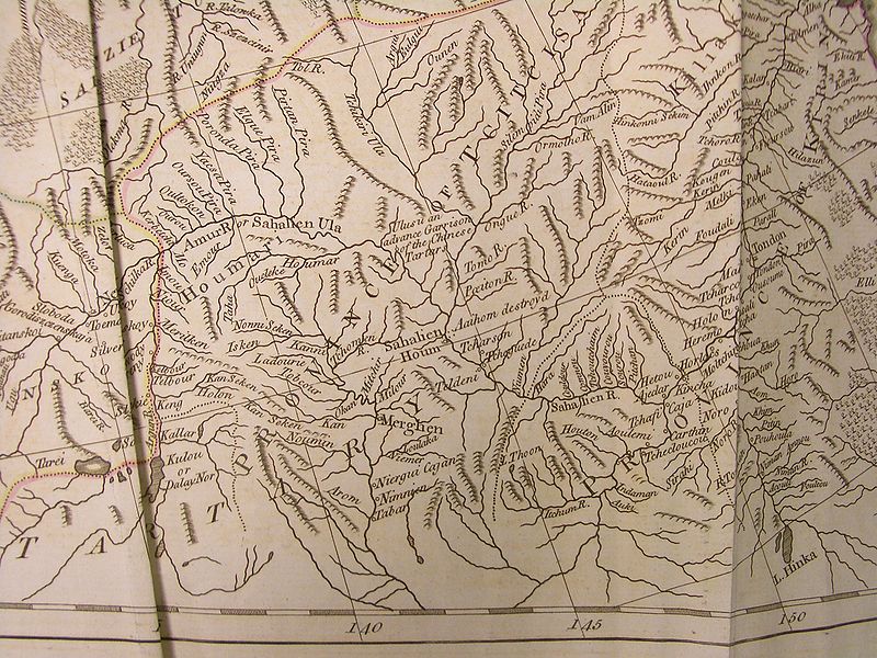
English: A fragment of the map of Russian Empire (pages 21-22), said to be based on d'Anville's work, in Thomas Kithen's "Atlas describing the Whole Universe"
English: The upper and middle Amur region, then part of "Chinese Tartary", and the adjacent parts of Russian Empire |
| تاریخ | |
| ماخذ |
English: "A General Atlas describing the whole Universe, being a Compleat and New Collection of the most approved Maps extant; Corrected with utmost Care, and augmented from the latest Discoveries; the whole thing being an Improvement of the Maps of d'Anville and Robert. Engraved in the best Manner on Sixty-Two Copper Plates, By Thomas Kitchen, Senior, and Others". "London: Printed for Robert Sayer, Map and Printseller, at No. 53, in Fleet-Street. MDCCLXXIII" (i.e., 1773). Each map in the atlas has its particular author indicated as well.
Русский: "Общий атлас всей Вселенной", изданный в Лондоне в 1773 г. Издатель Томас Китчен. |
| مصنف | and Thomas Kitchen (or his staff) |
| اجازت (فائل کا دوبارہ استعمال) |
Author died more than 70 years ago - public domain |

|
This work is in the public domain in its country of origin and other countries and areas where the copyright term is the author's life plus 100 years or fewer. | |
| This file has been identified as being free of known restrictions under copyright law, including all related and neighboring rights. | |
فائل کا تاریخچہ
کسی خاص وقت یا تاریخ میں یہ فائل کیسی نظر آتی تھی، اسے دیکھنے کے لیے اس وقت/تاریخ پر کلک کریں۔
| تاریخ/وقت | تھمب نیل | ابعاد | صارف | تبصرہ | |
|---|---|---|---|---|---|
| رائج الوقت | 07:51، 5 اپریل 2009ء | | 2,560 × 1,920 (2.03 MB) | Vmenkov | {{Information |Description={{en|A fragment of the map of Russian Empire (pages 21-22), said to be based on d'Anville's work, in Thomas Kithen's "Atlas describing the Whole Universe"}} {{en|The upper and Middle Amur region, then part of "Chinese Tartary"} |
روابط
درج ذیل صفحہ اس فائل کو استعمال کر رہا ہے:
فائل کا عالمی استعمال
مندرجہ ذیل ویکیوں میں یہ فائل زیر استعمال ہے:
- arz.wikipedia.org پر استعمال
- bg.wikipedia.org پر استعمال
- ca.wikipedia.org پر استعمال
- ceb.wikipedia.org پر استعمال
- cs.wikipedia.org پر استعمال
- en.wikipedia.org پر استعمال
- et.wikipedia.org پر استعمال
- fa.wikipedia.org پر استعمال
- it.wikipedia.org پر استعمال
- pl.wikipedia.org پر استعمال
- ru.wikipedia.org پر استعمال
- sv.wikipedia.org پر استعمال
- vi.wikipedia.org پر استعمال
- www.wikidata.org پر استعمال
- zh.wikipedia.org پر استعمال