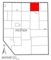
فائل:Map of Potter County, Pennsylvania Highlighting Bingham Township.PNG

اصل فائل (1,542 × 1,813 پکسل، فائل کا حجم: 91 کلوبائٹ، MIME قسم: image/png)

یہ فائل ویکی ذخائر کی ہے اور دیگر منصوبوں کے زیر استعمال ہوسکتی ہے۔ فائل کے صفحہ تعارف پر موجود تعارف ذیل میں موجود ہے۔

تفصیل A map of Potter County showing Bingham Township, Pennsylvania (alternate) highlighted on the map.
تاریخ
ماخذ Source image taken from the United States Census Bureau's website pa_cosub.pdf and modified by User:Dincher
مصنف US Census, Dincher
اجازت
(فائل کا دوبارہ استعمال)

US Census / US Government work is public domain, my modifications licensed under the GNU Free Documentation License

میں اس کام کا کاپی رائٹ ہولڈر ہوں اور اسے مندرجہ ذیل اجازت ناموں کے تحت شائع کیا ہے:
GNU head Permission is granted to copy, distribute and/or modify this document under the terms of the GNU Free Documentation License, Version 1.2 only as published by the Free Software Foundation; with no Invariant Sections, no Front-Cover Texts, and no Back-Cover Texts. A copy of the license is included in the section entitled GNU Free Documentation License. فقط 1.2 
w:en:Creative Commons
انتساب یکساں شراکت
This file is licensed under the Creative Commons Attribution-Share Alike 2.5 Generic, 2.0 Generic and 1.0 Generic license.
آپ آزاد ہیں:
  • شیئر کرنے – کام کو نقل، تقسیم یا منتقل کرنے کے لیے
  • ریمکس کے لیے – کام منبطق کرنے کے لیے
مندرجہ ذیل شرائط کے تحت:
  • انتساب – آپ کو اس کام کا انتساب مصنف یا اجازت دہندہ کے بتائے گئے طریقہ کے مطابق دینا ہوگا (تاہم یہ انتساب اس طرح نہیں ہونا چاہیے کہ اسے دیکھ کر ایسا محسوس ہو کہ اصل مصنف یا اجازت دہندہ آپ کے یا آپ کے ذریعہ اس کام کے استعمال کرنے کے حامی ہیں)۔
  • یکساں شراکت – اگر آپ اس کام میں کوئی تبدیلی یا ترمیم کرتے ہیں یا اس کام پر مبنی کچھ نیا بناتے ہیں تو اسے بھی آپ اسی یا اس جیسے کسی اجازت نامے کے تحت شائع کر سکتے ہیں۔
آپ حسب منشا اجازت نامہ منتخب کر سکتے ہیں۔
دوسرے نسخے

Image:Map of Potter County, Pennsylvania.png - Source map before highlighting (with text).

Image:Map of Potter County, Pennsylvania No Text.png - Source map before highlighting (without text).

Captions

Add a one-line explanation of what this file represents

Items portrayed in this file

عکاسی

جنوری 2008

فائل کا تاریخچہ

کسی خاص وقت یا تاریخ میں یہ فائل کیسی نظر آتی تھی، اسے دیکھنے کے لیے اس وقت/تاریخ پر کلک کریں۔

تاریخ/وقتتھمب نیلابعادصارفتبصرہ
رائج الوقت17:20، 8 نومبر 2008ءمورخہ 17:20، 8 نومبر 2008ء کا تھمب نیل1,542 × 1,813 (91 کلوبائٹ)RuhrfischEast Fork no longer exists, removed border between it and Wharton Township. All other information is the same.
01:44، 23 جنوری 2008ءمورخہ 01:44، 23 جنوری 2008ء کا تھمب نیل1,542 × 1,813 (92 کلوبائٹ)Gerry D{{Information| |Description={{PennMapDesc|Potter|Bingham Township}} |Source=Source image taken from the United States Census Bureau's website [http://www2.census.gov/geo/maps/general_ref/cousub_outline/cen2k_pgsz/pa_cosub.pdf pa_cosub.pdf] and modified by

درج ذیل صفحہ اس فائل کو استعمال کر رہا ہے:

فائل کا عالمی استعمال

مندرجہ ذیل ویکیوں میں یہ فائل زیر استعمال ہے: