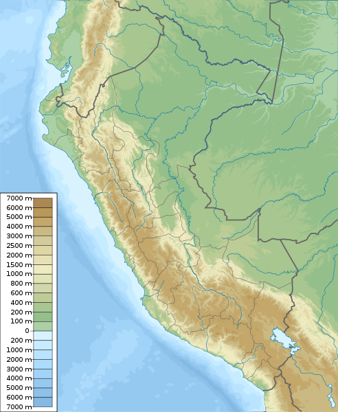
فائل:Peru physical map.svg

اس SVG فائل کی PNG نمائش کا حجم: 492 × 600 پکسلز دیگر تصمیمات: 197 × 240 پکسلز | 394 × 480 پکسلز | 630 × 768 پکسلز | 840 × 1,024 پکسلز | 1,681 × 2,048 پکسلز | 851 × 1,037 پکسلز۔
اصل فائل (ایس وی جی فائل، ابعاد 851 × 1,037 پکسل، فائل کا حجم: 4.81 MB)
فائل کا تاریخچہ
کسی خاص وقت یا تاریخ میں یہ فائل کیسی نظر آتی تھی، اسے دیکھنے کے لیے اس وقت/تاریخ پر کلک کریں۔
| تاریخ/وقت | تھمب نیل | ابعاد | صارف | تبصرہ | |
|---|---|---|---|---|---|
| رائج الوقت | 10:42، 5 مارچ 2011ء |  | 851 × 1,037 (4.81 MB) | Urutseg | == Summary == {{Information |Description ={{en|1=Physical map of Peru, parameters are equal to Bolivia location map.svg}} |Source ={{own}} |Author =Urutseg |Date =2011-03-05 |Pe |
روابط
درج ذیل صفحہ اس فائل کو استعمال کر رہا ہے:
فائل کا عالمی استعمال
مندرجہ ذیل ویکیوں میں یہ فائل زیر استعمال ہے:
- ar.wikipedia.org پر استعمال
- ast.wikipedia.org پر استعمال
- az.wikipedia.org پر استعمال
- ban.wikipedia.org پر استعمال
- ba.wikipedia.org پر استعمال
- bcl.wikipedia.org پر استعمال
- be-tarask.wikipedia.org پر استعمال
- be.wikipedia.org پر استعمال
- bg.wikipedia.org پر استعمال
اس فائل کا مزید عالمی استعمال دیکھیے۔