فائل:U.S. Counties.png
اس نمائش کا حجم: 800 × 591 پکسلز۔ دیگر تصمیمات: 320 × 237 پکسلز | 640 × 473 پکسلز | 1,024 × 757 پکسلز | 1,280 × 946 پکسلز | 2,560 × 1,893 پکسلز | 4,200 × 3,105 پکسلز۔
اصل فائل (4,200 × 3,105 پکسل، فائل کا حجم: 1.55 MB، MIME قسم: image/png)
خلاصہ
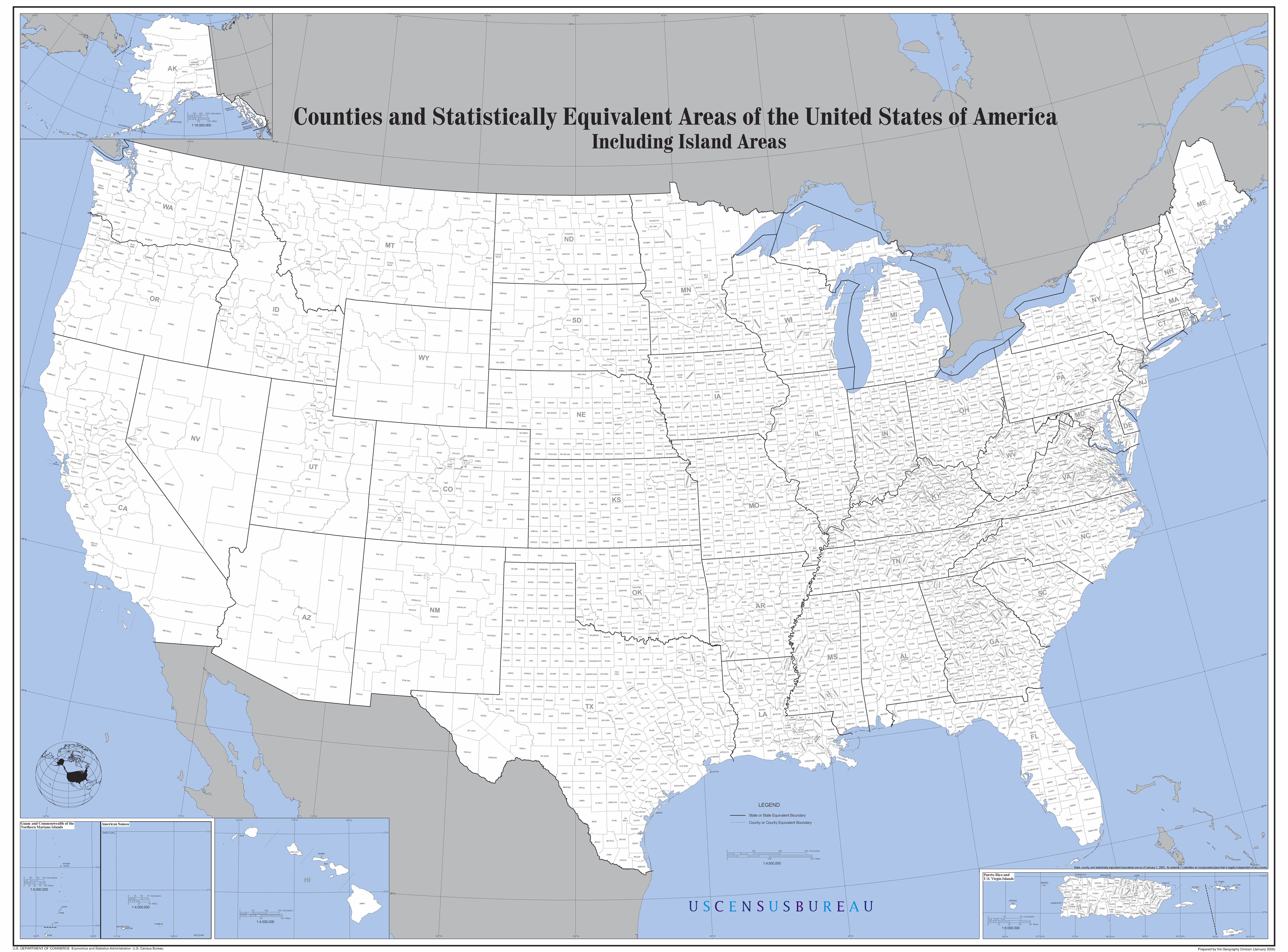
Map of the United States showing all counties.
Work of the U.S. Census Bureau. From the Census website.
اجازہ کاری
This work is in the public domain in the United States because it is a work prepared by an officer or employee of the United States Government as part of that person’s official duties under the terms of Title 17, Chapter 1, Section 105 of the US Code.
Note: This only applies to original works of the Federal Government and not to the work of any individual U.S. state, territory, commonwealth, county, municipality, or any other subdivision. This template also does not apply to postage stamp designs published by the United States Postal Service since 1978. (See § 313.6(C)(1) of Compendium of U.S. Copyright Office Practices). It also does not apply to certain US coins; see The US Mint Terms of Use.
|
 | |
| This file has been identified as being free of known restrictions under copyright law, including all related and neighboring rights. | ||
فائل کا تاریخچہ
کسی خاص وقت یا تاریخ میں یہ فائل کیسی نظر آتی تھی، اسے دیکھنے کے لیے اس وقت/تاریخ پر کلک کریں۔
| تاریخ/وقت | تھمب نیل | ابعاد | صارف | تبصرہ | |
|---|---|---|---|---|---|
| رائج الوقت | 20:04، 16 جولائی 2015ء | | 4,200 × 3,105 (1.55 MB) | Cmdrjameson | Compressed with pngout. Reduced by 632kB (28% decrease). |
| 12:26، 30 جون 2007ء |  | 4,200 × 3,105 (2.17 MB) | AldeBaer | Map of the United States showing all counties. |
روابط
اس فائل سے مربوط کوئی صفحہ موجود نہیں ہے۔