فائل:USACE Dexter Lake and Dam.jpg
اس نمائش کا حجم: 800 × 524 پکسلز۔ دیگر تصمیمات: 320 × 210 پکسلز | 640 × 419 پکسلز | 1,024 × 671 پکسلز | 1,500 × 983 پکسلز۔
اصل فائل (1,500 × 983 پکسل، فائل کا حجم: 520 کلوبائٹ، MIME قسم: image/jpeg)
| تفصیل |
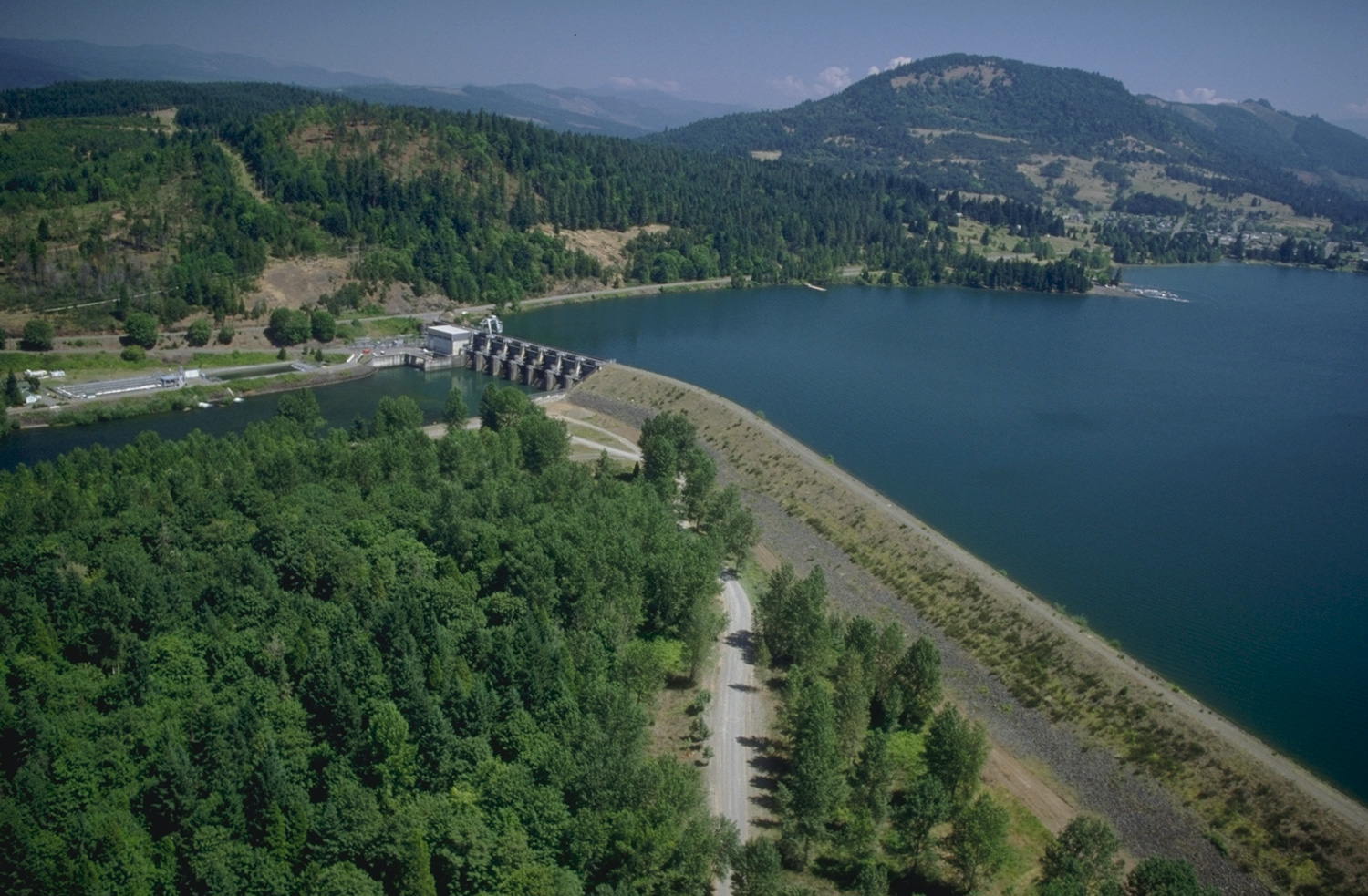
English: Aerial view of Dexter Lake and Dam on the Middle Fork Willamette River in Lane County, Oregon, with the city of Lowell visible in the upper right. The dam is located in Lane County approximately 16 miles (26 km) southeast of Eugene, Oregon. U.S. Army Corps of Engineers website on Dexter Lake |
|||
| Location | Dexter, Lane County, Oregon, USA 43°55′23.99″N 122°48′20.83″W / 43.9233306°N 122.8057861°W |
|||
| تاریخ | ||||
| ماخذ |
U.S. Army Corps of Engineers Digital Visual Library Image page Image description page Digital Visual Library home page |
|||
| مصنف | Bob Heims, U.S. Army Corps of Engineers | |||
| اجازت (فائل کا دوبارہ استعمال) |
|
فائل کا تاریخچہ
کسی خاص وقت یا تاریخ میں یہ فائل کیسی نظر آتی تھی، اسے دیکھنے کے لیے اس وقت/تاریخ پر کلک کریں۔
| تاریخ/وقت | تھمب نیل | ابعاد | صارف | تبصرہ | |
|---|---|---|---|---|---|
| رائج الوقت | 01:25، 18 اپریل 2007ء | | 1,500 × 983 (520 کلوبائٹ) | DanMS | {{Information2 | Description = {{en|Aerial view of Dexter Lake and Dam on the Willamette River at Dexter, Oregon. The dam is located in Lane County approximately 16 miles (26 km) southeast of Eugene, Oregon.<br />[http://corpslakes.usace.army.mil/visit |
روابط
درج ذیل 2 صفحات اس فائل کو استعمال کر رہے ہیں:
فائل کا عالمی استعمال
مندرجہ ذیل ویکیوں میں یہ فائل زیر استعمال ہے:
- de.wikipedia.org پر استعمال
- en.wikipedia.org پر استعمال