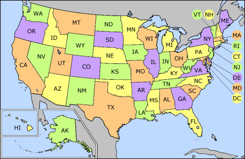
فائل:US state abbrev map.png
US_state_abbrev_map.png (501 × 327 پکسل، فائل کا حجم: 31 کلوبائٹ، MIME قسم: image/png)
فائل کا تاریخچہ
کسی خاص وقت یا تاریخ میں یہ فائل کیسی نظر آتی تھی، اسے دیکھنے کے لیے اس وقت/تاریخ پر کلک کریں۔
| تاریخ/وقت | تھمب نیل | ابعاد | صارف | تبصرہ | |
|---|---|---|---|---|---|
| رائج الوقت | 17:31، 24 ستمبر 2014ء |  | 501 × 327 (31 کلوبائٹ) | Robin van der Vliet | Lossless compression |
| 03:24، 5 مئی 2005ء |  | 501 × 327 (32 کلوبائٹ) | Mattes | new |
روابط
درج ذیل 5 صفحات اس فائل کو استعمال کر رہے ہیں:
فائل کا عالمی استعمال
مندرجہ ذیل ویکیوں میں یہ فائل زیر استعمال ہے:
- ab.wikipedia.org پر استعمال
- ar.wikinews.org پر استعمال
- azb.wikipedia.org پر استعمال
- bh.wikipedia.org پر استعمال
- bn.wikipedia.org پر استعمال
- bs.wikipedia.org پر استعمال
- Kategorija:Gradovi u Sjedinjenim Američkim Državama
- Kategorija:Okruzi u Sjedinjenim Američkim Državama po saveznim državama
- Kategorija:Glavni gradovi okruga u Sjedinjenim Američkim Državama
- Kategorija:Američka kultura po saveznim državama
- Kategorija:Američki mediji po saveznim državama
- Kategorija:Košarka u Sjedinjenim Američkim Državama po saveznim državama
- Kategorija:Sport u Sjedinjenim Američkim Državama po saveznim državama
- ca.wikipedia.org پر استعمال
- cs.wikipedia.org پر استعمال
- da.wikipedia.org پر استعمال
- de.wikipedia.org پر استعمال
- el.wikipedia.org پر استعمال
- en.wikipedia.org پر استعمال
- List of American military installations
- List of U.S. state and territory abbreviations
- Category:State governments of the United States
- Category:Categories by state or territory of the United States
- User:Fadookie
- Category:States of the United States
- User:Fadookie/Userbox
- Category:Radio stations in the United States by state
- Category:Mass media in the United States by state or territory
- Category:Communications in the United States by state or territory
- Category:Lists of newspapers published in the United States by state
- Category:Television stations in the United States by state
- Category:Films set in the United States by state
- Category:Restaurants in the United States by state or territory
- Category:American people by state or territory
- Category:Architecture in the United States by state
- Category:Health in the United States by state
- User:Northamerica1000/Notepad
- Category:Newspapers published in the United States by state
- Lists of restaurants
- User:Visviva/Map
- Category:Lists of African-American newspapers
- Category:COVID-19 pandemic in the United States by state
- User:Iketsi/sandbox/disc golf
- eo.wikipedia.org پر استعمال
- fa.wikipedia.org پر استعمال
اس فائل کا مزید عالمی استعمال دیکھیے۔


