فائل:Waco Regional Airport TX 2006 USGS.jpg
اس نمائش کا حجم: 631 × 600 پکسلز۔ دیگر تصمیمات: 253 × 240 پکسلز | 505 × 480 پکسلز | 748 × 711 پکسلز۔
اصل فائل (748 × 711 پکسل، فائل کا حجم: 204 کلوبائٹ، MIME قسم: image/jpeg)
خلاصہ
| تفصیل |
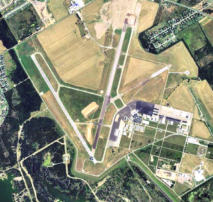
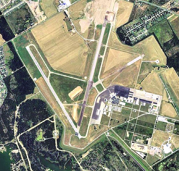
English: USGS digital orthophoto of Waco Regional Airport, formerly Blackland Army Airfield, in Waco, Texas, United States. |
| تاریخ | |
| ماخذ |
USGS via GPSvisualizer.com |
| مصنف | United States Geological Survey (USGS) |
| اجازت (فائل کا دوبارہ استعمال) |
Public domain |
| دوسرے نسخے |
 |
| Object location | | View this and other nearby images on: OpenStreetMap |
|---|
اجازہ کاری
This image is in the public domain in the United States because it only contains materials that originally came from the United States Geological Survey, an agency of the United States Department of the Interior. For more information, see the official USGS copyright policy.
|
فائل کا تاریخچہ
کسی خاص وقت یا تاریخ میں یہ فائل کیسی نظر آتی تھی، اسے دیکھنے کے لیے اس وقت/تاریخ پر کلک کریں۔
| تاریخ/وقت | تھمب نیل | ابعاد | صارف | تبصرہ | |
|---|---|---|---|---|---|
| رائج الوقت | 19:48، 24 نومبر 2011ء | | 748 × 711 (204 کلوبائٹ) | Bwmoll3 | {{Information |Description ={{en|1=Waco Regional Airport TX 2006 USGS}} |Source =http://www.gpsvisualizer.com/map_input?special=wikipedia&format=google&bg_map=usgs_aerial&sp_width=50km&form:data=type,name,latitude,longitude%0DW,%22Waco%20Region |
روابط
درج ذیل 2 صفحات اس فائل کو استعمال کر رہے ہیں:
فائل کا عالمی استعمال
مندرجہ ذیل ویکیوں میں یہ فائل زیر استعمال ہے:
- arz.wikipedia.org پر استعمال
- ceb.wikipedia.org پر استعمال
- de.wikipedia.org پر استعمال
- en.wikipedia.org پر استعمال
- en.wikivoyage.org پر استعمال
- fa.wikipedia.org پر استعمال
- fr.wikipedia.org پر استعمال
- ro.wikipedia.org پر استعمال
- tg.wikipedia.org پر استعمال
- www.wikidata.org پر استعمال