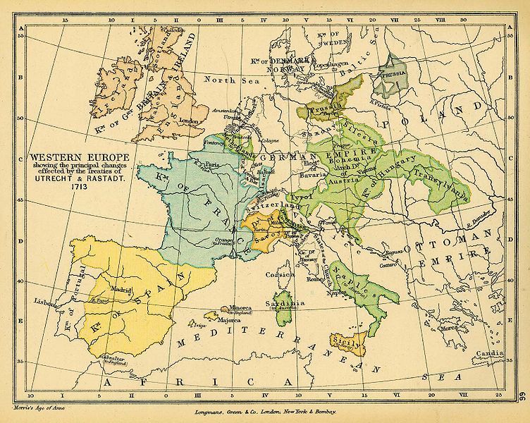
فائل:Western Europe Utrecht Treaty.jpg

اس نمائش کا حجم: 752 × 600 پکسلز۔ دیگر تصمیمات: 301 × 240 پکسلز | 602 × 480 پکسلز | 963 × 768 پکسلز | 1,280 × 1,021 پکسلز | 1,576 × 1,257 پکسلز۔
اصل فائل (1,576 × 1,257 پکسل، فائل کا حجم: 388 کلوبائٹ، MIME قسم: image/jpeg)
فائل کا تاریخچہ
کسی خاص وقت یا تاریخ میں یہ فائل کیسی نظر آتی تھی، اسے دیکھنے کے لیے اس وقت/تاریخ پر کلک کریں۔
| تاریخ/وقت | تھمب نیل | ابعاد | صارف | تبصرہ | |
|---|---|---|---|---|---|
| رائج الوقت | 16:38، 24 نومبر 2006ء |  | 1,576 × 1,257 (388 کلوبائٹ) | Louis le Grand~commonswiki | {{Information |Beschreibung= Landkarte Europa 1713 nach dem Frieden von Utrecht |Quelle= http://www.lib.utexas.edu/maps/historical/colbeck/western_europe_utrecht_treaty.jpg |Urheber= "The Public Schools Historical Atlas" by Charles Colbeck. Longmans, Gree |
روابط
درج ذیل صفحہ اس فائل کو استعمال کر رہا ہے:
فائل کا عالمی استعمال
مندرجہ ذیل ویکیوں میں یہ فائل زیر استعمال ہے:
- als.wikipedia.org پر استعمال
- ar.wikipedia.org پر استعمال
- ast.wikipedia.org پر استعمال
- bg.wikipedia.org پر استعمال
- br.wikipedia.org پر استعمال
- ca.wikipedia.org پر استعمال
- cs.wikipedia.org پر استعمال
- da.wikipedia.org پر استعمال
- de.wikipedia.org پر استعمال
- en.wikipedia.org پر استعمال
- eo.wikipedia.org پر استعمال
- eu.wikipedia.org پر استعمال
- fi.wikipedia.org پر استعمال
- fr.wikipedia.org پر استعمال
- fr.wikiversity.org پر استعمال
- he.wikipedia.org پر استعمال
- hu.wikipedia.org پر استعمال
- hy.wikipedia.org پر استعمال
- is.wikipedia.org پر استعمال
- it.wikipedia.org پر استعمال
- it.wikibooks.org پر استعمال
- ja.wikipedia.org پر استعمال
اس فائل کا مزید عالمی استعمال دیکھیے۔