فائل:Solomon Islands adm location map.svg

اصل فائل (ایس وی جی فائل، ابعاد 1,890 × 1,097 پکسل، فائل کا حجم: 148 کلوبائٹ)
خلاصہ
| تفصیل |
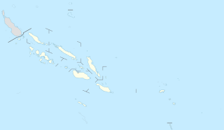
Deutsch: Positionskarte der Salomonen
English: Location map of the Solomon Islands
|
||||||||||||
| تاریخ | |||||||||||||
| ماخذ |
Own work using:
|
||||||||||||
| مصنف | NordNordWest | ||||||||||||

|
This map has been made or improved in the German Kartenwerkstatt (Map Lab). You can propose maps to improve as well.
|
اجازہ کاری
Usage of this file with:

explanatory notes: Legally binding is only the full legalcode. For a free usage I recommend to respect the following licence conditions:
1. Provide my name as given above: NordNordWest,
2. a copy of, or the URI for, the applicable license: https://creativecommons.org/licenses/by-sa/3.0/de/legalcode,
3. the title of the work,
4. in the case of an adaptation, a credit identifying the use of the work in the adaptation.
This license and the rights granted hereunder will terminate automatically upon any breach by you of the terms of this license. Any of the above conditions can be waived if you get permission from the copyright holder. If you have questions or wish differing conditions, please contact me through nnwest or my discussion page ![]() t-online.de
t-online.de
- آپ آزاد ہیں:
- شیئر کرنے – کام کو نقل، تقسیم یا منتقل کرنے کے لیے
- ریمکس کے لیے – کام منبطق کرنے کے لیے
- مندرجہ ذیل شرائط کے تحت:
- انتساب – آپ کو اس کام کا انتساب مصنف یا اجازت دہندہ کے بتائے گئے طریقہ کے مطابق دینا ہوگا (تاہم یہ انتساب اس طرح نہیں ہونا چاہیے کہ اسے دیکھ کر ایسا محسوس ہو کہ اصل مصنف یا اجازت دہندہ آپ کے یا آپ کے ذریعہ اس کام کے استعمال کرنے کے حامی ہیں)۔
- یکساں شراکت – اگر آپ اس کام میں کوئی تبدیلی یا ترمیم کرتے ہیں یا اس کام پر مبنی کچھ نیا بناتے ہیں تو اسے بھی آپ اسی یا اس جیسے کسی اجازت نامے کے تحت شائع کر سکتے ہیں۔

فائل کا تاریخچہ
کسی خاص وقت یا تاریخ میں یہ فائل کیسی نظر آتی تھی، اسے دیکھنے کے لیے اس وقت/تاریخ پر کلک کریں۔
| تاریخ/وقت | تھمب نیل | ابعاد | صارف | تبصرہ | |
|---|---|---|---|---|---|
| رائج الوقت | 16:54، 20 نومبر 2020ء | | 1,890 × 1,097 (148 کلوبائٹ) | NordNordWest | corr |
| 18:36، 15 مارچ 2017ء |  | 1,890 × 1,097 (147 کلوبائٹ) | NordNordWest | == {{int:filedesc}} == {{Information |Description= {{de|1=Positionskarte der Salomonen}} {{en|1=Location map of the Solomon Islands}} {{Location map series N |stretching=101 |top=-4.3 |bottom=-13.5 |left=154.4 |right=170.4 }} |Source={{Own using}} * Un... |
روابط
اس فائل سے مربوط کوئی صفحہ موجود نہیں ہے۔
فائل کا عالمی استعمال
مندرجہ ذیل ویکیوں میں یہ فائل زیر استعمال ہے:
- ast.wikipedia.org پر استعمال
- Ḥoniara
- Módulu:Mapa de llocalización/datos/Islles Salomón
- Módulu:Mapa de llocalización/datos/Islles Salomón/usu
- Makira
- Kirakira
- Islles Florida
- Islles Nueva Xeorxa
- Vangunu
- Islla de Rennell
- Kolombangara
- Golfu de Kula
- Llaguna de Marovo
- Ranongga
- Nggatokae
- Simbo
- Islles Arnarvon
- Islla Bellona
- Islla de Ghizo
- Islles Duff
- Islla Malaita
- Islla de Savo
- Gavutu
- Islla Kennedy
- Islles Reef
- Islla Choiseul
- Vella Lavella
- Islla Nueva Xeorxa
- Tinakula
- Islla Furona
- Islla de Santa Isabel
- Malaita Sur
- Islla Nendö
- Taumako
- Rennell Este
- Islles Santa Cruz
- Tulagi
- Islla Fera
- Fatutaka
- Anuta
- Tikopia
- Pavuvu
- Utupua
- bn.wikipedia.org پر استعمال
- de.wikipedia.org پر استعمال
اس فائل کا مزید عالمی استعمال دیکھیے۔