فائل:Mehrgarh pakistan rel96.JPG
اس نمائش کا حجم: 489 × 600 پکسلز۔ دیگر تصمیمات: 196 × 240 پکسلز | 391 × 480 پکسلز | 978 × 1,199 پکسلز۔
اصل فائل (978 × 1,199 پکسل، فائل کا حجم: 573 کلوبائٹ، MIME قسم: image/jpeg)
خلاصہ
| تفصیل |
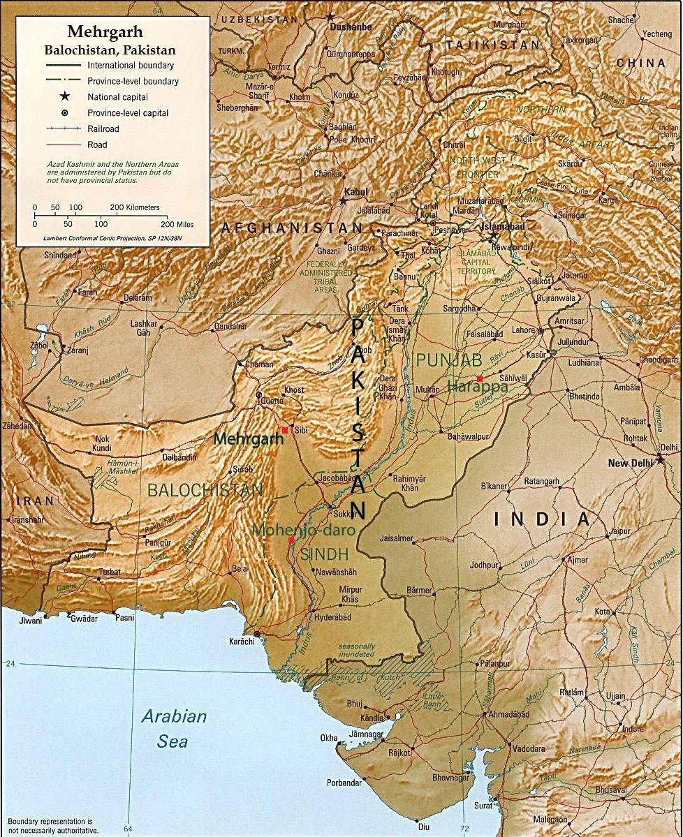
English: This is an annotated version of a relief map of Pakistan in the public domain([1]). The map was annotated by Fowler&fowler«Talk» 08:07, 7 March 2007 (UTC) and rereleased to the public domain. |
| تاریخ | 7 مارچ 2007 (original upload date) |
| ماخذ | Transferred from en.wikipedia to Commons. |
| مصنف | Fowler&fowler at انگریزی ویکیپیڈیا |
اجازہ کاری
| تخلیق کار Fowler&fowler at انگریزی ویکیپیڈیا نے اس کام کو دائرہ عام میں شائع کیا ہے جس کا اطلاق عالمی سطح پر ہوتا ہے۔ بعض ملکوں میں یہ قانونی طور پر شاید ممکن نہ ہو؛ اگر ایسا ہے تو: Fowler&fowler ہر ایک کو کسی بھی مقصد کے لیے بغیر کسی شرط کے اس تصویر کے استعمال کا حق تفویض کرتا/کرتی ہے، بجز اس صورت کے جس میں کوئی قانونی رکاوٹ موجود ہو۔ |
اولین اپلوڈ کا نوشتہ
فائل کی تفصیلات کا اصل صفحہ یہاں تھا۔ درج ذیل تمام صارفین en.wikipedia کے ہیں۔
- 2007-03-07 08:07 Fowler&fowler 1104×1332×8 (363580 bytes) This is an annotated version of a relief map of Pakistan in the public domain([http://www.lib.utexas.edu/maps/faq.html]). The map was annotated by ~~~~ and rereleased to the public domain. {{PD-self}}
- 2007-03-07 08:07 Fowler&fowler 1104×1332×8 (363580 bytes) This is an annotated version of a relief map of Pakistan in the public domain([http://www.lib.utexas.edu/maps/faq.html]). The map was annotated by ~~~~ and rereleased to the public domain. {{PD-self}}
فائل کا تاریخچہ
کسی خاص وقت یا تاریخ میں یہ فائل کیسی نظر آتی تھی، اسے دیکھنے کے لیے اس وقت/تاریخ پر کلک کریں۔
| تاریخ/وقت | تھمب نیل | ابعاد | صارف | تبصرہ | |
|---|---|---|---|---|---|
| رائج الوقت | 19:31، 20 ستمبر 2011ء | | 978 × 1,199 (573 کلوبائٹ) | Fowler&fowler | Correcting position of Mehrgarh (which had been placed incorrectly by me in the previous version). ~~~~ |
| 19:17، 23 جنوری 2008ء |  | 1,104 × 1,332 (355 کلوبائٹ) | File Upload Bot (Magnus Manske) | {{BotMoveToCommons|en.wikipedia}} {{Information |Description={{en|This is an annotated version of a relief map of Pakistan in the public domain([http://www.lib.utexas.edu/maps/faq.html]). The map was annotated by [[:en:User:Fowler&fowler|<font color |
روابط
درج ذیل صفحہ اس فائل کو استعمال کر رہا ہے:
فائل کا عالمی استعمال
مندرجہ ذیل ویکیوں میں یہ فائل زیر استعمال ہے:
- arz.wikipedia.org پر استعمال
- be.wikipedia.org پر استعمال
- cs.wikipedia.org پر استعمال
- da.wikipedia.org پر استعمال
- en.wikipedia.org پر استعمال
- eo.wikipedia.org پر استعمال
- hi.wikipedia.org پر استعمال
- incubator.wikimedia.org پر استعمال
- ja.wikipedia.org پر استعمال
- ka.wikipedia.org پر استعمال
- ko.wikipedia.org پر استعمال
- lt.wikipedia.org پر استعمال
- ne.wikipedia.org پر استعمال
- nn.wikipedia.org پر استعمال
- no.wikipedia.org پر استعمال
- pa.wikipedia.org پر استعمال
- pnb.wikipedia.org پر استعمال
- pt.wikipedia.org پر استعمال
- sq.wikipedia.org پر استعمال
- sv.wikipedia.org پر استعمال
- ta.wikipedia.org پر استعمال
- te.wikipedia.org پر استعمال
- vi.wikipedia.org پر استعمال
- www.wikidata.org پر استعمال
- xmf.wikipedia.org پر استعمال