Tributary_Glacier.JPG(421 × 462 پکسل، فائل کا حجم: 23 کلوبائٹ، MIME قسم: image/jpeg)

یہ فائل ویکی ذخائر کی ہے اور دیگر منصوبوں کے زیر استعمال ہوسکتی ہے۔ فائل کے صفحہ تعارف پر موجود تعارف ذیل میں موجود ہے۔

خلاصہ

تفصیل
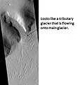
English: Tributary Glacier in Ismenenius Lacus, as seen by hirise. Location is 41.3 degrees north latitude and 54.7 degrees east longitude. Image was taken by the Mars Reconnaissance Orbiter's HiRISE. The HiRISE camera was built by Ball Aerospace and Technology Corporation and is operated by the University of Arizona. Image courtesy NASA/JPL/University of Arizona.
تاریخ May 4, 2009
ماخذ http://hirise.lpl.arizona.edu/PSP_008809_2215
مصنف Jim Secosky modified nasa image.

اجازہ کاری

Public domain This file is in the public domain in the United States because it was solely created by NASA. NASA copyright policy states that "NASA material is not protected by copyright unless noted". (See Template:PD-USGov, NASA copyright policy page or JPL Image Use Policy.)
Warnings:

فائل کا تاریخچہ

کسی خاص وقت یا تاریخ میں یہ فائل کیسی نظر آتی تھی، اسے دیکھنے کے لیے اس وقت/تاریخ پر کلک کریں۔

تاریخ/وقتتھمب نیلابعادصارفتبصرہ
رائج الوقت16:26، 4 مئی 2009ءمورخہ 16:26، 4 مئی 2009ء کا تھمب نیل421 × 462 (23 کلوبائٹ)Jimmarsmars{{Information |Description = Tributary Glacier in Ismenenius Lacus, as seen by hirise. Location is 41.3 degrees north latitude and 54.7 degrees east longitude. |Source =http://hirise.lpl.arizona.edu/PSP_008809_2215 |Date = May 4,

درج ذیل صفحہ اس فائل کو استعمال کر رہا ہے:

فائل کا عالمی استعمال

مندرجہ ذیل ویکیوں میں یہ فائل زیر استعمال ہے: