ڈینور، کولوراڈو
(ڈینور سے رجوع مکرر)
| City-county | |
| City and County of Denver | |
 Top to Bottom, Left to Right: Denver Skyline, Colorado State Capitol, Red Rocks Amphitheater, Sports Authority Field at Mile High, RTD Light Rail train Downtown. | |
| عرفیت: The Mile-High City Queen City of the West, Queen City of the Plains, Wall Street of the West | |
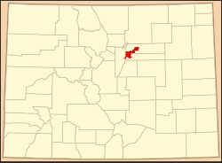
 Location of Denver in the کولوراڈو | |
| ملک | |
| ریاست | |
| City and County | Denver |
| Founded | November 22, 1858, as Denver City, K.T. |
| شرکۂ بلدیہ | 11/7/1861, as Denver City, C.T. |
| Consolidated | November 15, 1902, as the City and County of Denver |
| وجہ تسمیہ | James W. Denver |
| حکومت | |
| • قسم | Consolidated City and County |
| • مجلس | Denver City Council |
| • میئر | Michael Hancock (ڈیموکریٹک پارٹی) |
| رقبہ | |
| • City-county | 401.3 کلومیٹر2 (154.9 میل مربع) |
| • زمینی | 397.2 کلومیٹر2 (153.3 میل مربع) |
| • آبی | 4.1 کلومیٹر2 (1.6 میل مربع) 1.03% |
| • میٹرو | 21,793 کلومیٹر2 (8,414.4 میل مربع) |
| بلندی | 1,564–1,731 میل (5,130–5,690 فٹ) |
| آبادی (USCB estimate for July 1, 2012) | |
| • City-county | 634,265 (US: 23rd) |
| • کثافت | 1,561/کلومیٹر2 (4,044/میل مربع) |
| • میٹرو | 2,900,000 (US: 21st) |
| • نام آبادی | Denverite |
| منطقۂ وقت | MST (UTC−7) |
| • گرما (گرمائی وقت) | MDT (UTC−6) |
| زپ کوڈs | 80201–80212, 80214–80239, 80241, 80243–80244, 80246–80252, 80256–80266, 80271, 80273–80274, 80279–80281, 80290–80291, 80293–80295, 80299, 80012, 80014, 80022, 80033, 80123, 80127 |
| ٹیلی فون کوڈ | Both 303 and 720 |
| وفاقی اطلاعاتی عملکاری معیار | 08-20000 |
| GNIS feature ID | 0201738 |
| Highways | I-25, I-70, I-76, I-225, I-270, US 6, US 40, US 85, US 285, US 287, SH 2, SH 26, SH 30, SH 35, SH 83, SH 88, SH 95, SH 121, SH 177, SH 265, SH 470, E-470 |
| ویب سائٹ | City and County of Denver |
Second most populous Colorado county | |

