کک کاؤنٹی، الینوائے
کک کاؤنٹی، الینوائے (انگریزی: Cook County, Illinois) ریاستہائے متحدہ امریکا کا ایک کاؤنٹی جو الینوائے میں واقع ہے۔[1]
| کاؤنٹی | |
 The century-old, neoclassical County and City Hall building (left) in the Chicago Loop houses the County Board chambers and administrative offices | |
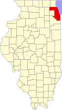
 Map of الینوائے showing Cook County | |
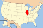
 Illinois's location in the ریاستہائے متحدہ امریکا | |
| ملک | |
| ریاست | |
| علاقہ | Northern Illinois |
| Metro area | شکاگو میٹروپولیٹن علاقہ |
| شرکۂ بلدیہ | January 15, 1831 |
| وجہ تسمیہ | Daniel Cook |
| کاؤنٹی نشست | |
| Largest city | |
| Incorporated Municipalities | 135 (total)
|
| حکومت | |
| • قسم | County |
| • مجلس | Board of Commissioners |
| • Board President | Toni R. Preckwinkle (ڈیموکریٹک پارٹی) |
| • County Board | 17 commissioners |
| رقبہ | |
| • کاؤنٹی | 4,230 کلومیٹر2 (1,635 میل مربع) |
| • زمینی | 2,450 کلومیٹر2 (945 میل مربع) |
| • آبی | 1,800 کلومیٹر2 (690 میل مربع) |
| • میٹرو | 28,160 کلومیٹر2 (10,874 میل مربع) |
| رقبہ درجہ | 6th largest county in Illinois |
| بلند ترین مقام | 290 میل (950 فٹ) |
| پست ترین مقام | 180 میل (580 فٹ) |
| آبادی (2010 ریاست ہائے متحدہ مردم شماری) | |
| • کاؤنٹی | 5,194,675 |
| • تخمینہ (2013) | 5,240,700 |
| • درجہ | 1st largest county in Illinois 2nd largest county in U.S. |
| • کثافت | 2,140/کلومیٹر2 (5,530/میل مربع) |
| • میٹرو | 9,522,434 |
| منطقۂ وقت | وسطی منطقۂ وقت (UTC-6) |
| • گرما (گرمائی وقت) | وسطی منطقۂ وقت (UTC-5) |
| زپ کوڈ Prefixes | 600xx thru 608xx |
| Area codes | 224/847, 312/872, 773/872, 708 |
| Congressional districts | 1st, 2nd, 3rd, 4th, 5th, 6th, 7th, 8th, 9th 10th and 11th |
| وفاقی اطلاعاتی عملکاری معیار | 17-031 |
| جغرافیائی ناموں کا نظام معلومات feature ID | 1784766 |
| Interstates | |
| U.S. Routes | |
| State Routes | |
| Airports | Chicago O'Hare International مڈوے بین الاقوامی ہوائی اڈا شکاگو ایگزیکٹو ہوائی اڈا لینسنگ میونسپل ہوائی اڈا شامبرگ ریجنل ہوائی اڈا |
| آبی گذرگاہیں | جھیل مشی گن – Chicago River Chicago Sanitary and Ship Canal Calumet River – Des Plaines River North Shore Channel |
| Amtrak stations | Chicago Union Station Glenview – Homewood La Grange – Summit |
| Public transit | Chicago Transit Authority (CTA) Metra – Pace – South Shore Line |
| ویب سائٹ | www.cookcountyil.gov |
تفصیلات
ترمیمکک کاؤنٹی، الینوائے کا رقبہ 4,234.65 مربع کیلومیٹر ہے اور اس کی مجموعی آبادی 5,194,675 افراد پر مشتمل ہے۔
مزید دیکھیے
ترمیمحوالہ جات
ترمیم- ↑ انگریزی ویکیپیڈیا کے مشارکین۔ "Cook County, Illinois"
|
|
